Mapping of the seafloor with modern multibeam echosounders provides the morphology
Morphology of the seafloor is provided from mapping with mutlibeam echosounders, which allows to deduce a number of geological processes. With a lot of questions the character of the seafloor is of importance as well. This can be supported by sidescan sonar application.
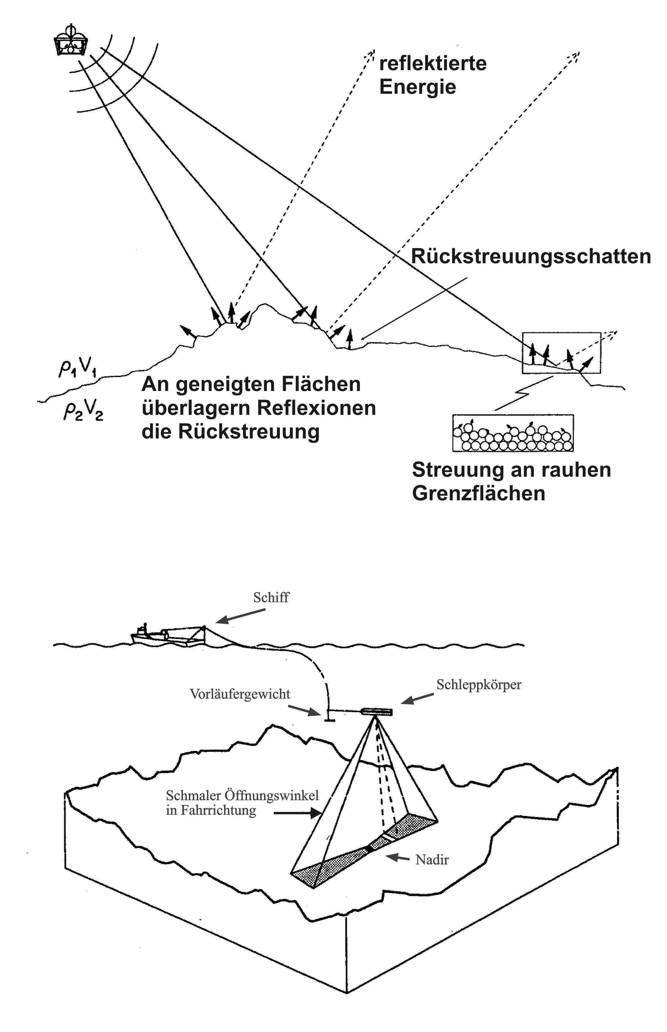
Sidescan sonars transmit an acoustic signal from the side of the system carrier (the “tow fish”). The signal will be reflected once it hits an interface with different acoustic impedance. Refraction of the reflected signal will point away from the tow fish and the signal will get lost. Scattering will take place if the interface is not completely even and a small part of the scattered signal will be directed back to the tow fish.
Character of the seafloor, angle of incidence of the signal and tilt of the seafloor will influence the strength of the back scattered signal. Roughness of the seafloor is the major aspect in this process. Gravel surfaces are rougher than sand, which is rougher than clay. Therefore different sediments will provide different back scatter signals from the seafloor.
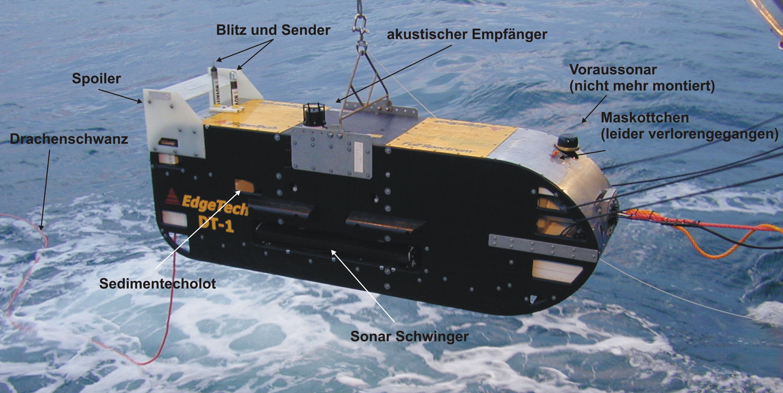
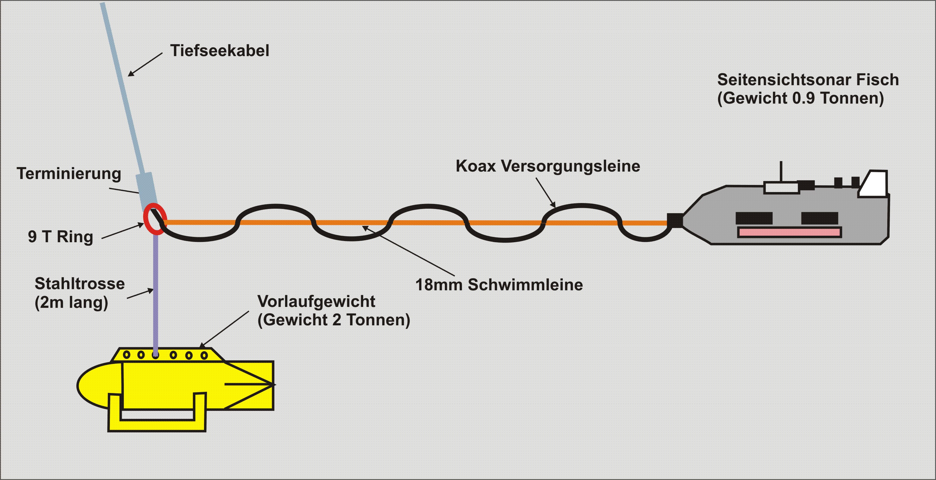
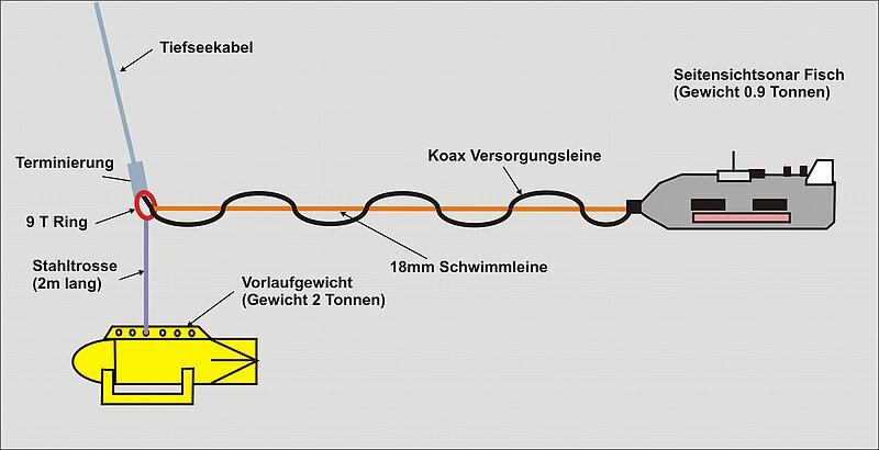
The DTS-1 system (deep towed sidescan sonar) operated by GEOMAR is a deep towed sidescan sonar. It will be towed about 100 m above the seafloor. A 45 m long umbilical connects the fish with a depressor weight, which is connected to the deep sea cable of a surface vessel.
DTS-1 can be operated with two different frequencies:
75 kHz; height above seafloor 75 – 100 m; beam width 1500 m; resolution 1 m
410 kHz; height above seafloor 15 – 20 m; beam width 300 m; resolution 0.25 m
Maximum operation depth: 6,000 m