Chile: On the Track of Aftershocks
Marine Scientists Publish Data on the Illapel Earthquake in the Year 2015
A team of earthquake experts from Kiel, Santiago de Chile and Potsdam has published an evaluation of the Illapel earthquake from September 16th, 2015 in the journal Geophysical Journal International. Therein the scientists recognized clear patterns of the spread of the aftershocks.
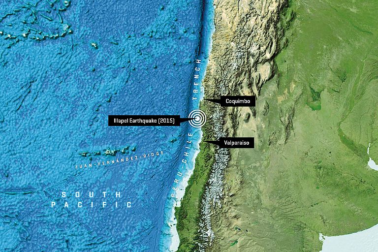
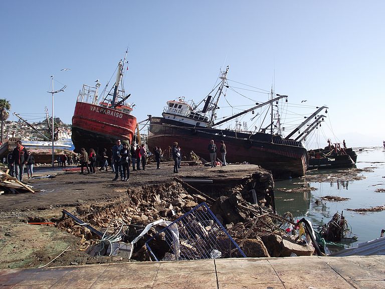
Destroyed houses, flooded districts, stranded ships – on September 16, 2015, the four-and-a-half meter high tsunami hit the Chilean harbor city Coquimbo and caused great devastation. The cause of the tidal wave was an earthquake with a magnitude of 8.3. It had its origin near the city Illapal which lies 180 kilometers further south. Even several days later the aftershocks still shook the region. Fortunately, there were hardly any casualties because of good preparation of the population and timely warnings about the tsunami.
Directly after the tremors, not only did the clean-up begin in the affected region but also the scientific evaluation of the quake. With the help of a dense seismic measuring net of the Chilean seismological service, the team, made up of experts from the GEOMAR Helmholtz Centre for Ocean Research Kiel, the Cluster of Excellence “The Future Ocean”, the University of Santiago de Chile and the Helmholtz-Centre Potsdam - GFZ German Research Centre for Geosciences (GFZ), was able to detect a pattern in the spread of the aftershocks. “Thus, the Illapel earthquake expands our knowledge about the processes in the deep underground, during and after the earthquake“, emphasizes Dr. Dietrich Lange from GEOMAR, lead author of the study, which has now been published in the journal Geophysical Journal International.
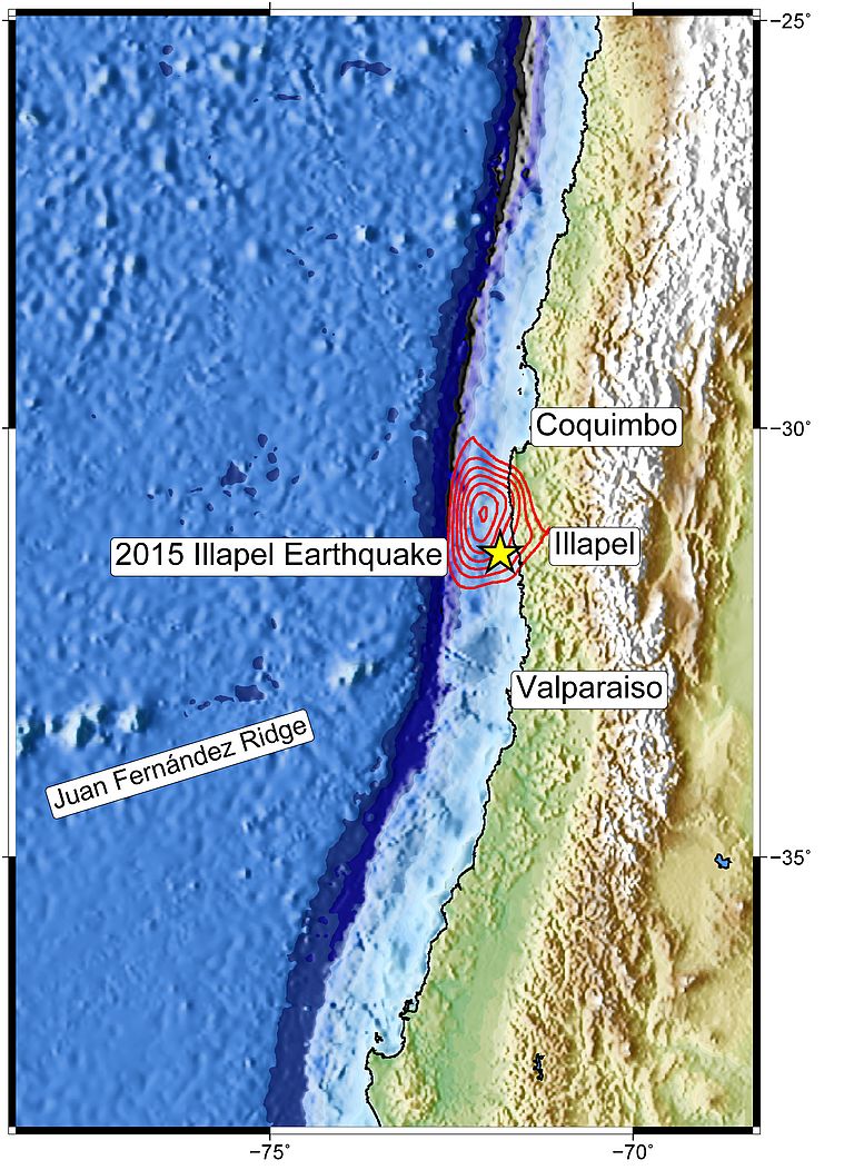
The data of 30 measuring stations on the Chilean mainland between the 26th and the 35th latitude south were at the disposal of the scientists. From the beginning of 2013 until the beginning of 2016, they recorded more than 5,000 seismic events – among them also the main quake from September 16, 2015, as well as smaller foreshocks and numerous aftershocks. “Chile is regularly hit by major earthquakes. For this reason, the country has invested a lot into security measures and into earthquake research and has built a very dense permanent station network over the last few years,” explains Dr. Lange.
The data show that the aftershocks spread with a speed of 2.5 kilometer per second towards the North and at double speed towards the South from the rupture zone of the main quake. In the South the spread ended at the 33rd Southern latitude. There, a chain with seamounts which runs east to west, the Juan Férnandez Ridge, meets the Chilean coast at nearly a right angle. “The seamounts are part of the pacific Nazca earth plate. It plunges directly off the coast under the South American continental plate. This plunging is responsible for the high earthquake risk in Chile“, explains Dr. Geersen, co-author of the study.
The seamounts which are on the Nazca plate are also pushed under the continental plate in this process. “With the help of the recordings of the seismic stations and older measuring data, we were able to prove that the spread of the aftershocks ends there, where old seamounts reduce the tension between both earth plates. This confirms earlier studies which indicated that subducted seamounts act as earthquake stoppers,” says Dr. Geersen.
At the Illapel quake, scientists were able to prove that the aftershocks concentrated in two depths. “We had already recognized this distribution at other quakes in Chile, so they seem typical for the region – at least for the local earthquake zone”, continues Dr. Lange. However, why the quakes concentrate exactly on that spot is not yet sufficiently clear.
“The question of how far an earthquake spreads and where aftershocks appear is not only of interest to the researchers. It is equally important for risk assessment and for potential warning messages to the population,” says Dr. Lange. “The new data from Illapel does not provide us with ready-made answers. But they show patterns which can hopefully help us on the way to finding a solution.”
Original Publication:
Lange, D., J. Geersen, S. Barrientos, M. Moreno, I. Grevemeyer, E. Contreras-Reyes, H. Kopp (2016): Aftershock seismicity and tectonic setting of the 16 September 2015 Mw 8.3 Illapel earthquake, Central Chile. Geophysical Journal International,
http://dx.doi.org/10.1093/gji/ggw218
Contact:
Jan Steffen (GEOMAR,Communication & Media)
Phone: 0431 600-2811 presse(at)geomar.de


