The Scientific Programme of the Meteor Expedition
From descriptive oceanography to analytical oceanography
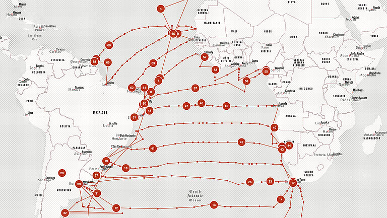
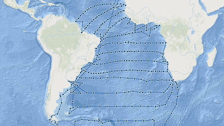
The German Atlantic Expedition (Deutsche Atlantische Expedition, DAE) produced impressive scientific results. More than 67,000 echo sounder measurements that were collected systematically greatly improved knowledge of the depths of the South Atlantic. The resulting higher-resolution image of the sea floor clearly showed the Mid-Atlantic Ridge for the first time. New shallows were discovered and, in some cases, named for the first time. At more than 300 stations, the researchers carried out chemical, physical and biological investigations, accompanied by atmospheric measurement series. This comprehensive research method marked the transition from purely descriptive marine science to analytical oceanography as it is practised today. Among other aspects, it enabled the detection of water exchange between the current systems of the northern and southern hemispheres.

Surveying the Seabed
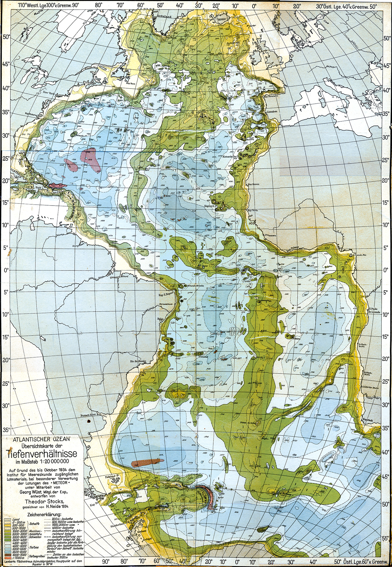
Depth map of the Atlantic Ocean by Theodor Stocks and Georg Wüst from 1934, based on echo soundings during the German Atlantic Expedition.
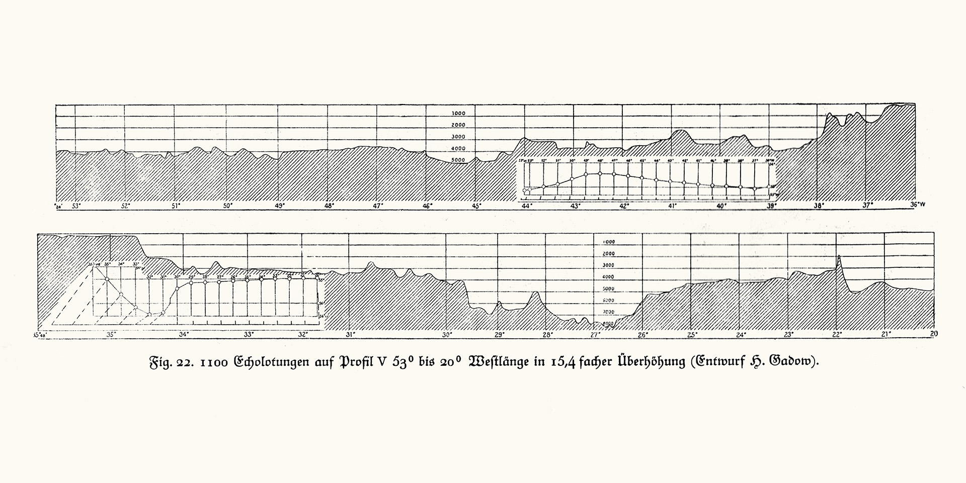
Echo soundings on profile V. Source: F. Spieß: Die Meteor-Fahrt, 1928, Fig. 22
Sealing the shock tube by Dr. Pratje. Photo: First Lieutenant Otto von Recum, DSM collection
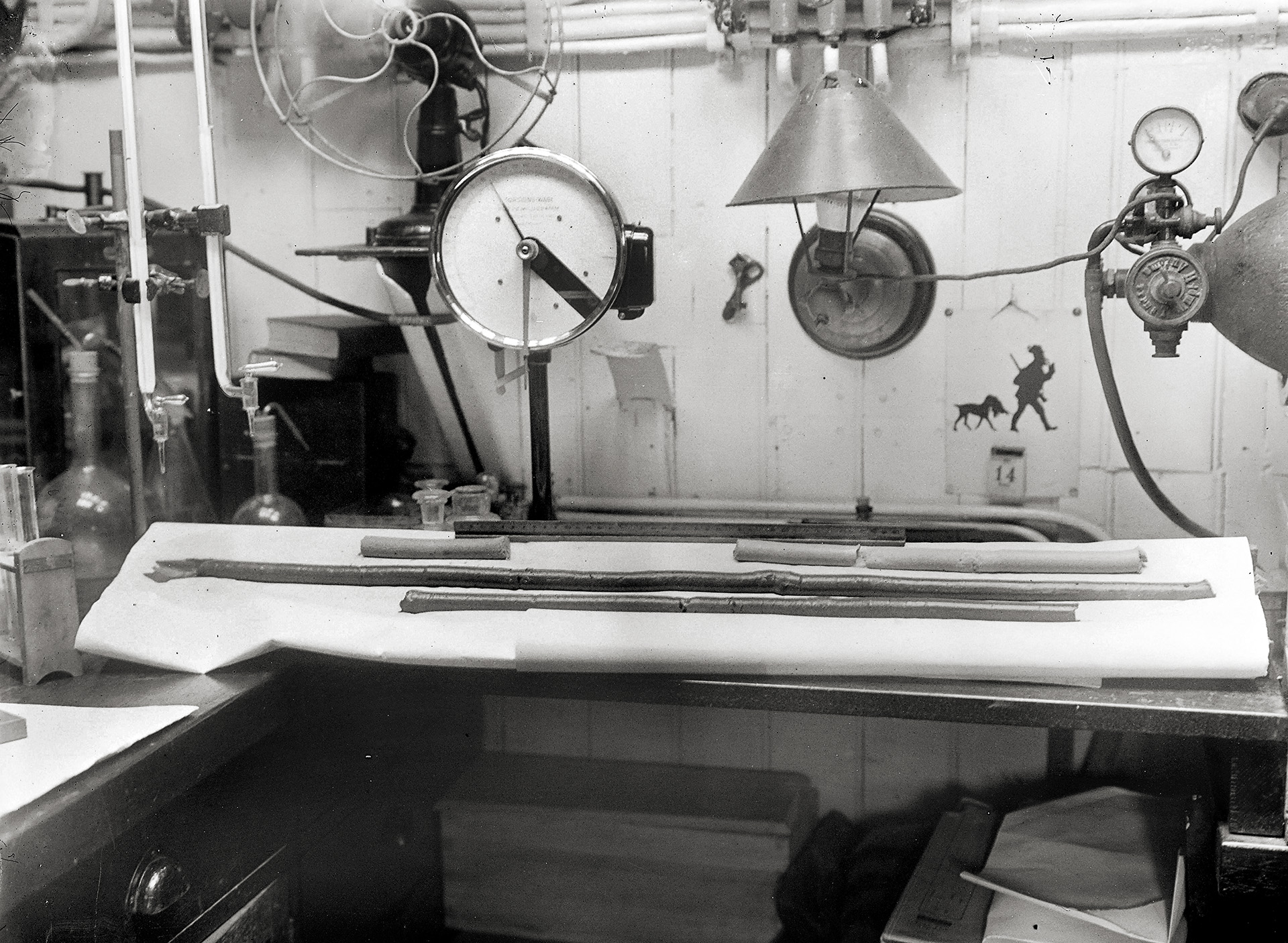
Ground Probe in the laboratory. Photo: Dr Otto Pratje, DSM Collection
Through regular soundings, the expedition provided a more detailed picture of the seabed in the South Atlantic than had previously been known. For the first time, a depth profile of the Mid-Atlantic Ridge was created that was accurate by the standards of the time, revealing a greater extent and stronger relief (additional heights and depths, basins and thresholds) than scientists had previously assumed. A total of around 67,000 echo soundings were taken during the expedition and 14 depth profiles of the Atlantic were created.
During the voyage, measurements were usually taken three times per hour at full speed using the echosounding equipment of the Atlas company and the Signal society, resulting in a distance of about 2 to 3 nautical miles between measurements. In areas with uneven relief, soundings were taken more frequently. The more time-consuming, traditional wire soundings with the Lucas sounding machine and thermometric depth measurements could only be carried out at the pre-defined stations.
A corer containing a glass tube and the bottom grab brought sediment samples on board, which were examined for their components and grain sizes. In addition, the salinity of the bottom water above the sediment was determined.
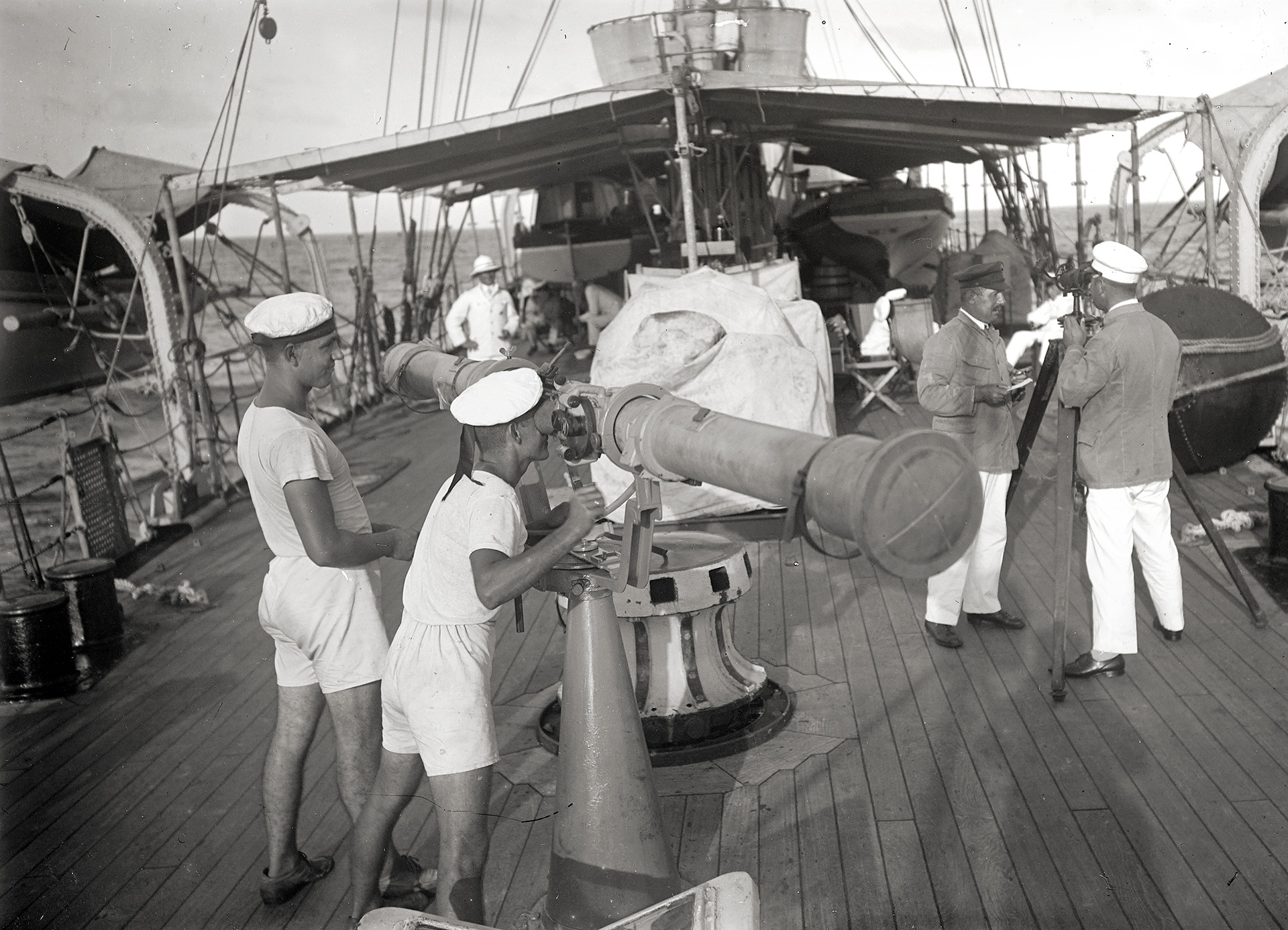
About the equipment
- Behm echo sounder: In 1912 (the year the Titanic sank), Alexander Behm applied for a patent for the echo sounding method. His "Behmlot", which was intended to make shipping safer and was further tested during the DAE, worked with a detonator cartridge. It reached depths of up to 750 metres and was still quite inaccurate and unreliable at that time. Today, Behm is considered the inventor of the echo sounder. The DAE heralded the era of echo sounder measurements.
- Sonic log: up to 200 metres deep, torpedo-shaped explosive device with a detonating charge that detonated on contact with the seabed and triggered a sound; the fall time was the basis for calculating the water depth. (due to the short range, not the sound).
- Signal-Lot (Signalgesellschaft) and Atlas-Lot (Atlas company): These devices worked with sound waves generated by electromagnets, with the transmitter and receiver housed in the ship's hull. They worked reliably and provided consistent data. The main measurements of the DAE came from these devices.
Excerpts from Captain Spieß's diary on the Behmlot:
11 January 1925: "Beautiful weather, we are heading for the Strait of Magellan. We are conducting tests with the Behmlot. A lot of cartridges are failing. The device often swings and the calibration is incorrect."
10 November 1925: "Tests are being carried out with the Behmlot, which is now working well."
7 April 1926: "We are testing the Behmlot on flat water, which is not working again this time, and then continuing to sound experimentally."
Discovery of the Meteor Bank

During the expedition, a new undersea threshold was also discovered, surveyed and named – the "Meteor Bank".
Excerpt from Captain Spieß's diary on the "Meteor Bank":
18 October 1925: "In the morning, we find a bank using the echo sounder, we take a sounding at 800 m and station 65. We then name the bank 'Meteor Bank' or 'Meteor Ridge' in a meaningful reference to yesterday's Bouvet Ridge (named Meteor – Bouvet 1870). We sound the bank; it is a perfect cone rising to 590 m."
Excerpt from the expedition report, Work on Profile III on the METEOR Bank:
"At the geographical longitude of Bouvet Island, a threshold rising to 1500 m was identified, the connection of which to the Bouvet Plateau is to be investigated in more detail on Profile V. To the east of this, at 4S0 16'S and 8°14'E, a self-contained bank was found and sounded as planned. This is a bank rising from a depth of 3000 m in a south-west to north-east direction with a minimum depth of 560 m. It does not appear to be of volcanic origin. It has been given the name 'Meteor Bank'."
The survey and description of the Challenger Deep, the Valdivia Bank, the Walvis Ridge, the Bouvet Threshold, the St. Peter and St. Paul Rocks and the Nelson Bank are also mentioned.
Ocean Currents and Physical Parameters
Large four-litre water sampler.
Photo: DSM Collection
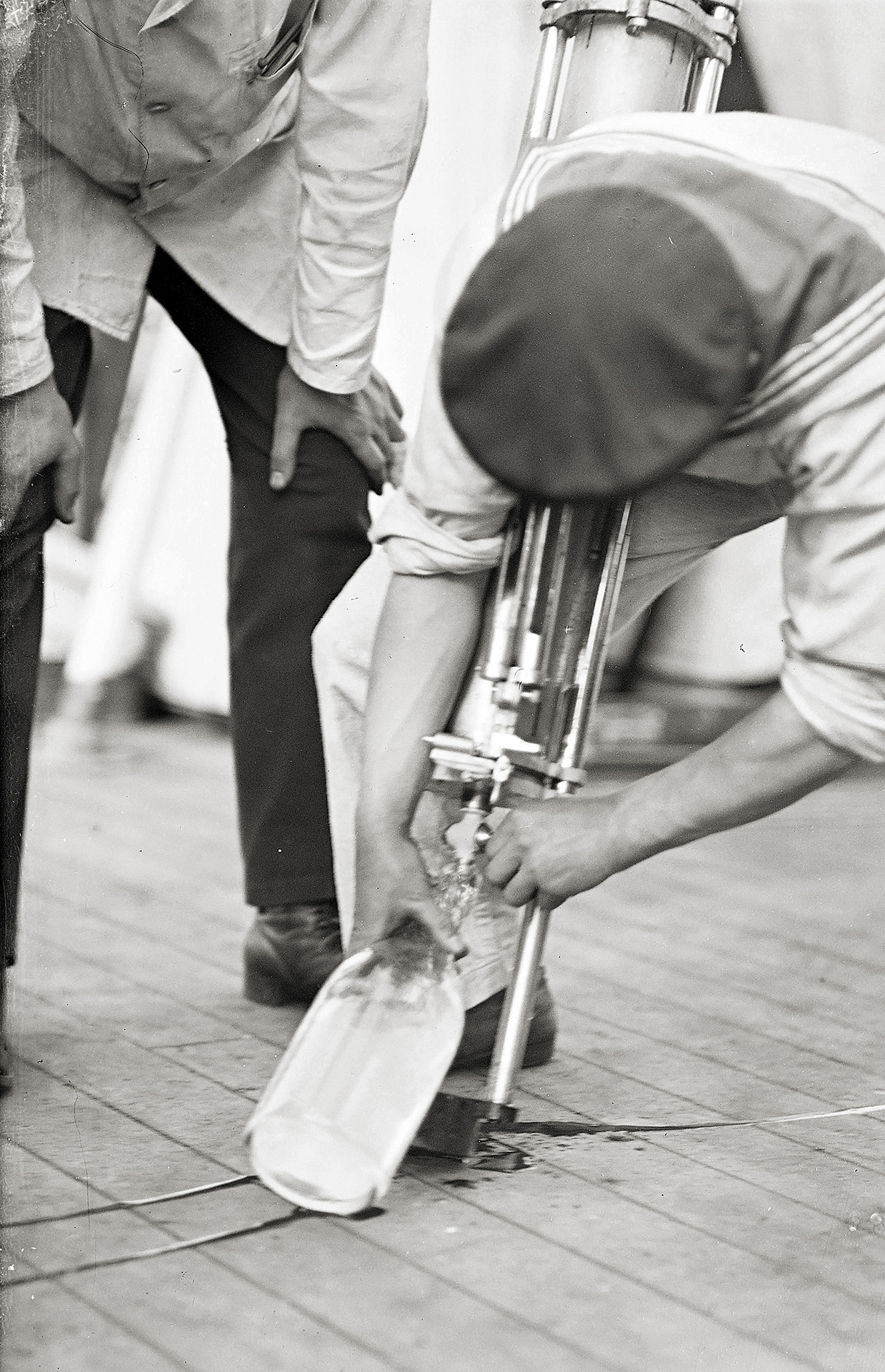
Water being drawn from the four-litre water sampler. Photo: Dr Hermann Wattenberg, DSM Collection
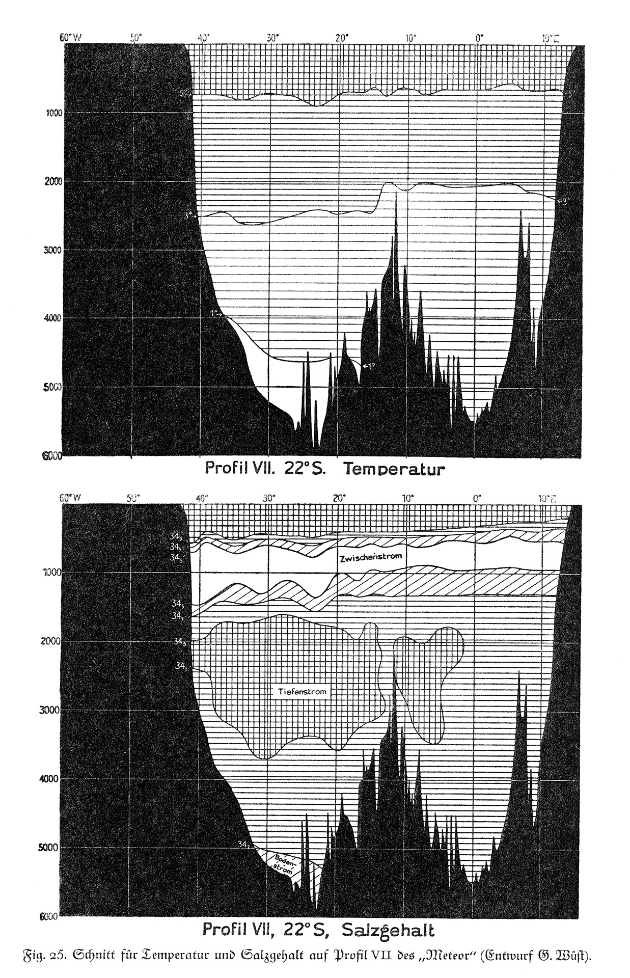
Section for temperature and salinity on profile VII. Source: F. Spieß: Die Meteor-Fahrt, 1928, Fig. 25
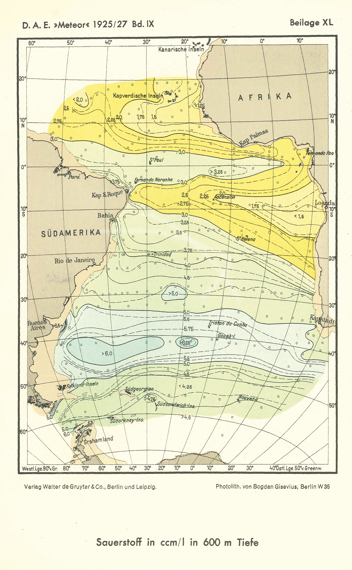
Oxygen at a depth of 600 metres. Source: D.A.E. Meteor 1925/27 Vol. IX
Alfred Merz defined the recording of vertical currents (mixing), a new topic in marine research at the time, as one of the central tasks of the expedition in addition to (horizontal) ocean circulation. This is discussed in detail in the expedition report, "Report on the oceanographic investigations (Observers: Dr Böhnecke, Dr Meyer, Dr Schumacher, Dr Wüst)":
"The main task of the expedition is to address the problem of Atlantic horizontal and vertical circulation with the ultimate goal of quantifying it, or, as Merz succinctly put it: the true movement in space is to be determined. (...) It can be said that Merz thus ushered in a new era of marine research for the world's oceans, namely the era of intensive spatial exploration of an entire extensive ocean area."
At 310 stations along the 14 depth profiles, the researchers examined temperature, salinity and oxygen content. In doing so, they discovered a striking stratification, which they believed was caused by oceanic circulation and interrupted by the seabed relief and regional currents.
Researchers also examine water samples for chlorine content, hydrogen ion concentration, oxygen content, carbon dioxide pressure and alkalinity, phosphoric acid content and other chemical properties, which they correlate with circulation (and the living conditions of plankton).
Various measuring instruments in use:
- Ekman-Merz current meter
- Ekman repeating current meter
- Dutchman's log
- Water sampler
- Large four-litre water water sampler (modification of the water sampler designed by Otto Krümmel)
- Series water sampler (tilt water sampler that can be connected in series of up to twelve)
- Surface thermometer
- Tilt thermometer (temperature measurements below 1000 metres)
- Message bottles
- Visibility measurement with Secchi disc
Marine Life and Plankton Counts
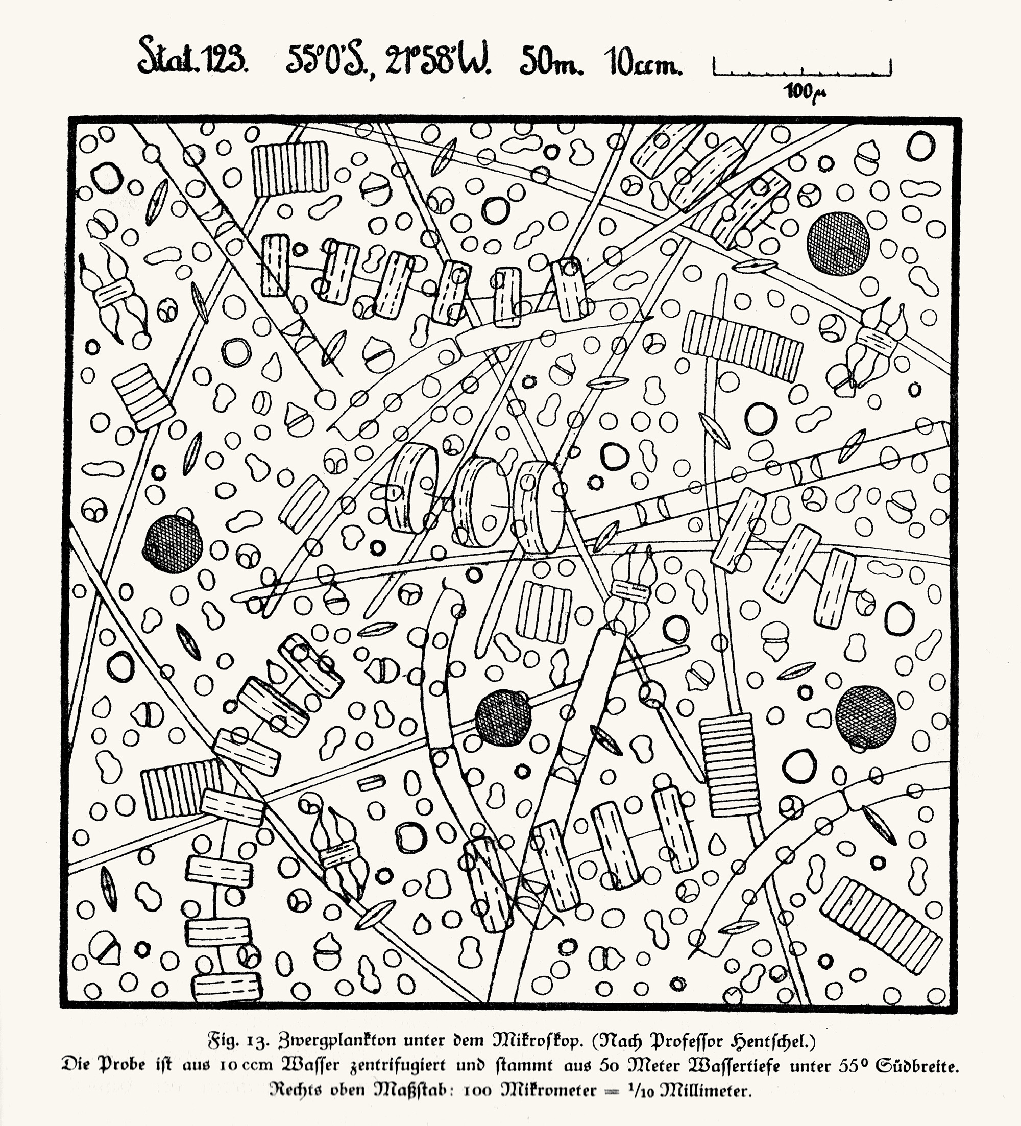
Nanozooplankton under the microscope (according to Prof. Hentschel). Source: F. Spieß: Die Meteor-Fahrt, 1928, Fig. 13
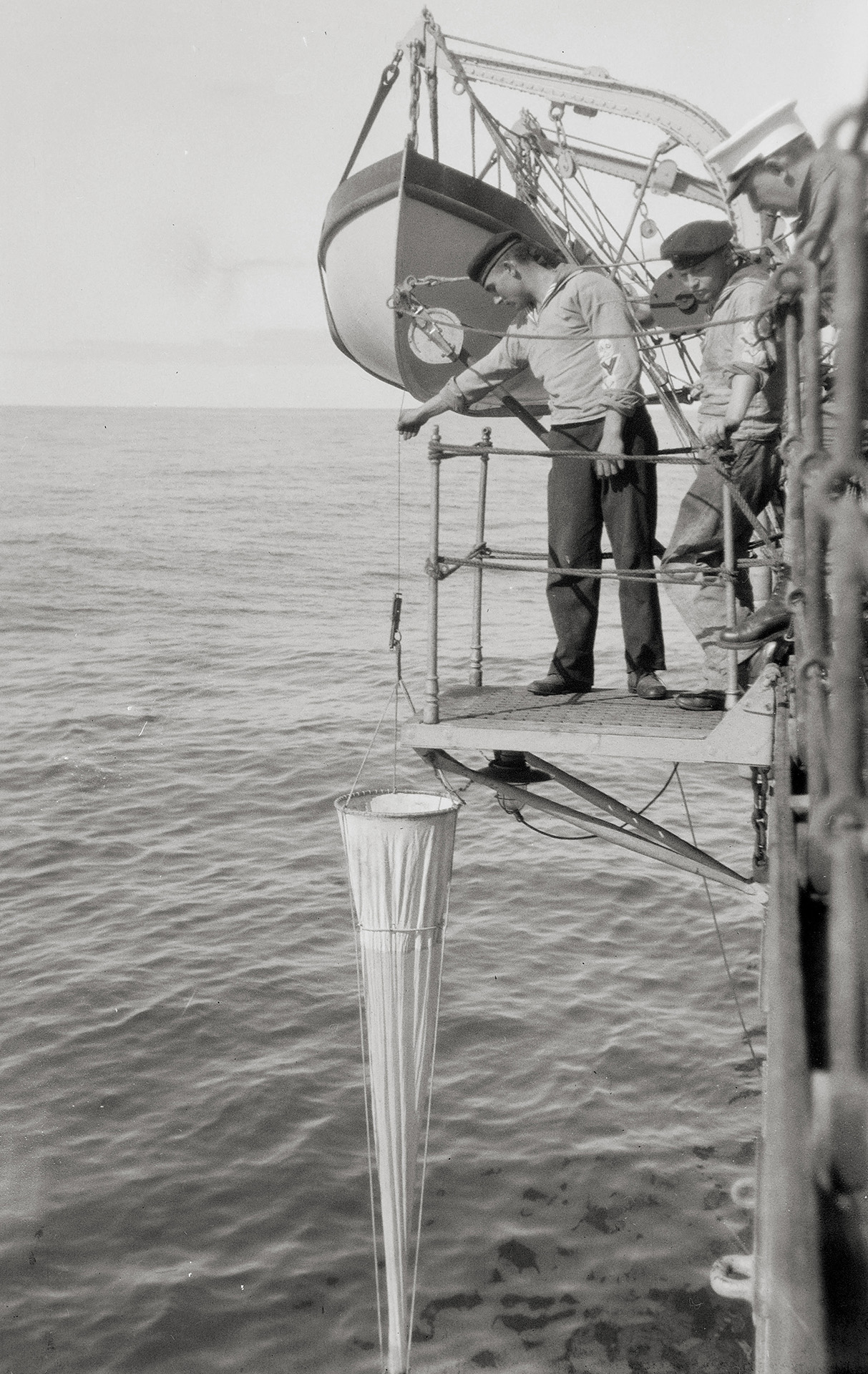
Net fishing with a plankton net.
Photo: First Lieutenant Otto von Recum, DSM collection
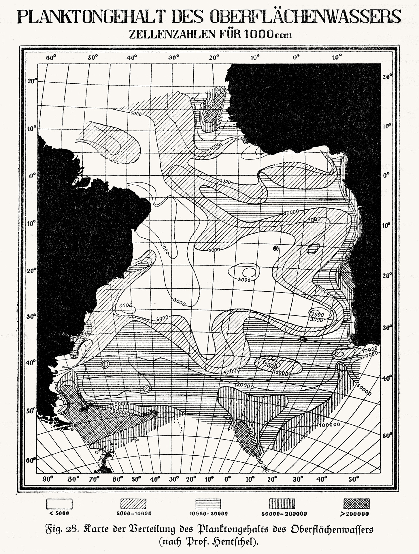
Distribution of plankton content in surface water (according to Prof. Hentschel).
Source: F. Spieß: Die Meteor-Fahrt, 1928, Fig. 28
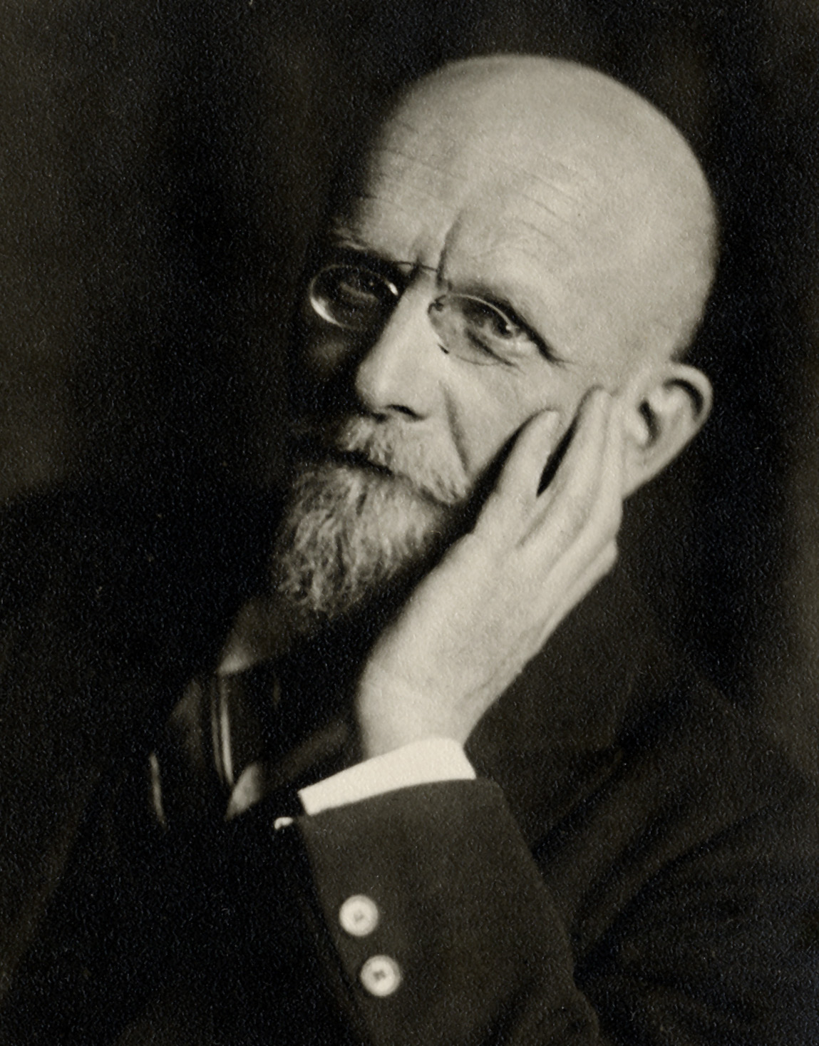
Portrait of Professor Ernst Hentschel.
Photo: GEOMAR archive
Marine biology was less of a focus of the expedition, but is regularly mentioned in the captain's log and carefully summarised in the expedition report. The researchers correlate their observations and plankton count results with oceanographic parameters ("production conditions"), mixing and current conditions. In addition to oxygen, they emphasise the importance of nutrient distribution through vertical mixing for plankton. The expedition claims to have conducted the first plankton counts in "all layers of the ocean" and to have depicted the distribution in longitudinal and cross-sections. The work of zoologist Hans Lohmann (methodology, conclusions) is used as a guide, although he was only able to study plankton at depths of up to 400 metres during his expeditions. Frequent mention is also made of observations of bioluminescence, holothurians and jellyfish caught in the equipment, marine mammals, seabirds and terrestrial animals. The captain highlights the rare finds of deep-sea fish in his diary, sometimes even making sketches. The description of "globerine mud" also takes up a certain amount of space.
The equipment used includes the Apstein Net (to a depth of 200 metres) and the Nansen Closing Net (from 1000 to 700 metres and from 500 to 200 metres) for collecting, identifying and counting larger plankton species, and the Secchi Disc ("white disc") for determining visibility depth. For the quantitative recording of nanoplankton, smaller quantities of water (100 and 540 millilitres), which are obtained from various depths using water samplers, centrifuged and then counted "while still alive" under the microscope. Further information was obtained by sedimentation of water samples and the filtration of seawater from the deck wash pump.
In his expedition report, biologist Ernst Hentschel describes how living conditions along all profiles influence the composition, predominant species and total numbers of plankton. In his description, zones with equal amounts of plankton are delimited by "isoplankton" lines. He highlights a major difference between the plankton in the northern (north of 25°) and southern (south of 30°) Atlantic: At a depth of 200 metres, the plankton abundance (average number of individuals per litre of water) in the south is about twice as high as in the north, while at a depth of 2000 metres the abundance is approximately the same. He explains the observed plankton scarcity on Profile II at 25° to 30°S partly by a disturbance caused by two undersea ridges (Rio Grande Ridge, Walvis Ridge), which divide the water masses, but also suspects other causes that are unclear to him.
Excerpts from the expedition report, Report on Biological Work, by Ernst Hentschel:
"The existence of a climatically determined zonal distribution, the structuring effect of currents and, at the same time, the independence of populations from these complex factors, things that Lehmann had already clearly demonstrated, were clearly evident. There appeared to be signs of periodicity in the life cycle of plankton."
"At the beginning of our expedition, the lightless deep sea was, in the truest sense of the word, mare incognitum for quantitative plankton research. We have now established that in the area of our first three profiles, the water at all depths is still so densely populated with nannoplankton that in little more than half a litre (540 cm³) of water, almost without exception, a few organisms can still be found. This deep-sea plankton is not only an impoverished version of the upper layer plankton, but is also somewhat characteristic..."
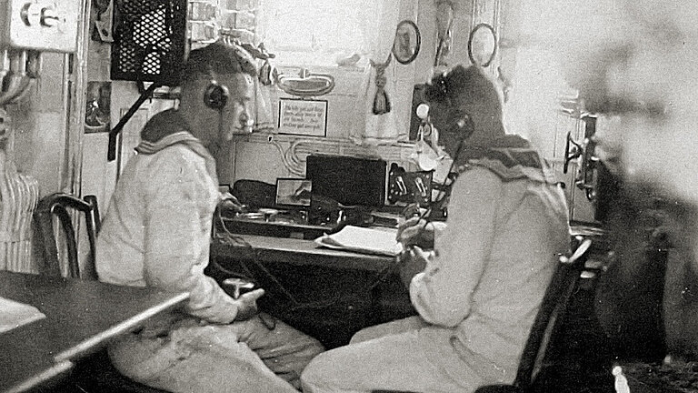
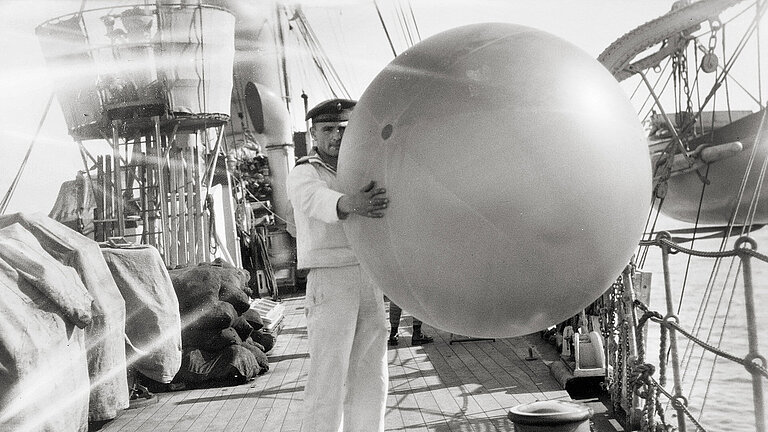
Meteorological Measurements
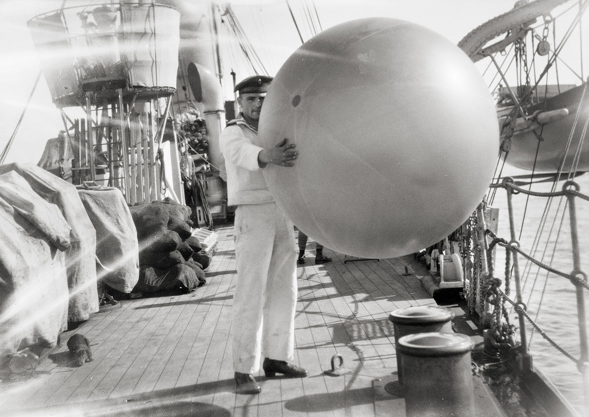
Preparation of a recording balloon.
Photo: Otto von Recum, DSM Collection
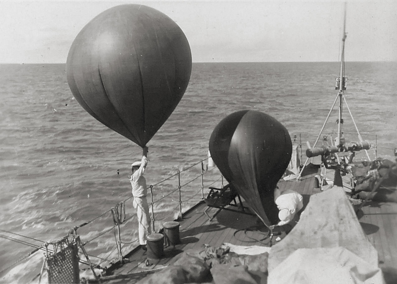
Ascent of a pilot balloon.
Photo: DSM collection
Pilot balloon tracking.
Photo: Otto von Recum, DSM collection
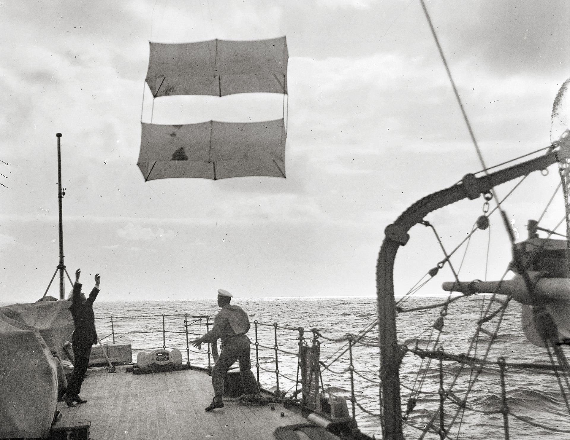
Ascent of a meteorological kite.
Photo: Otto von Recum, DSM Collection
![[Translate to English:] An der Drachenwinde.](/fileadmin/content/entdecken/meteor-100/Meteorologie/I-11299_22_Pos.1361_003-ed-mid.jpg)
An der Drachenwinde.
Foto: Dr. Georg Wüst, Sammlung DSM
In the field of meteorology, the researchers aimed to decipher dependencies on ocean circulation, "since, in addition to regional differences in the physical properties of seawater, it is mainly the winds that determine ocean circulation." They also suspected that atmospheric circulation followed similar rules to those in the ocean and that there was a comparable division between the northern and southern hemispheres. They provided initial fundamental findings for the South Atlantic, which had been little researched to date.
The measurements were carried out as follows:
- Hourly: temperature, air pressure, cloud cover, visibility, sea state
- Additionally three times a day ("scheduled measurements"): air pressure, air and water temperature, humidity, wind direction, wind force, cloud shape and coverage, sea state and visibility, radio report to Germany
- Pilot balloons: ascents almost daily, measurement of wind force and direction, up to 3,000 to 10,000 metres, maximum 21,000 metres altitude
- Recording balloons: sensors in cork box for temperature, pressure, humidity
- Kite ascents: temperature, pressure, humidity, wind speed at altitudes of 2,000 to 3,000 metres, maximum 4,500 metres
Excerpts from Captain Spieß's diary on meteorological measurements:
03.02.27: "We are conducting a registration balloon ascent. The first balloon bursts prematurely after about 20 minutes at an altitude of approximately 5000 metres. The signal balloon is continuously tracked and located, but also bursts prematurely, so that after 45 minutes we have to run at full speed to reach the spot where the envelope and instrument are floating in the water. We get it a little later than the estimated time, and the signal man Spiekermann in the foremast receives the 10 Reichsmark reward on his birthday, of all days. The meteorologists attribute the premature bursting of the balloon to the intense heat, which causes the balloons to expand too quickly. At least the instrument reached an altitude of 4780 metres."
15 October 1925: "...The meteorologists did not continue measuring the pilot balloon today because they mistook it for a star, which happened to them recently with Venus. Yesterday's station showed the temperature inversion typical of Arctic regions: cold at the top, then warm, then cold again."