
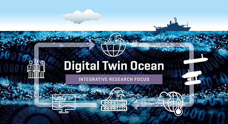
Digital Twin Ocean
An Integrative Research Focus (IRF) of GEOMAR
Digital Twins, as interactive, 4D visualizations will bundle and provide access to sensor data and simulations to explore “what if” scenarios.
What are Digital Twins?
Digital Twins are a method to analyze complex systems. The method itself was developed for engineering applications and is being used more frequently for earth system use cases.
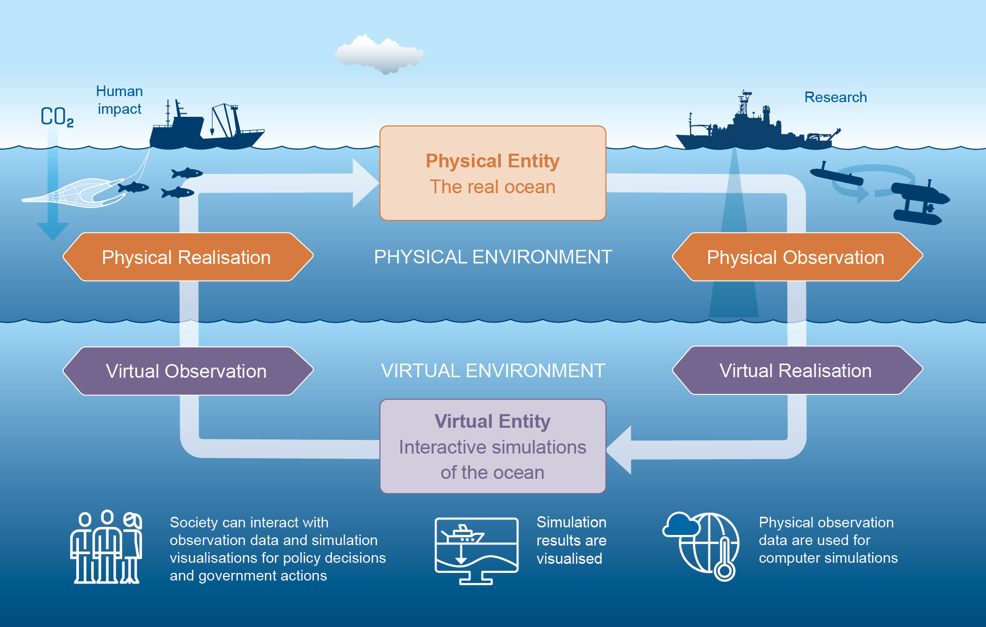
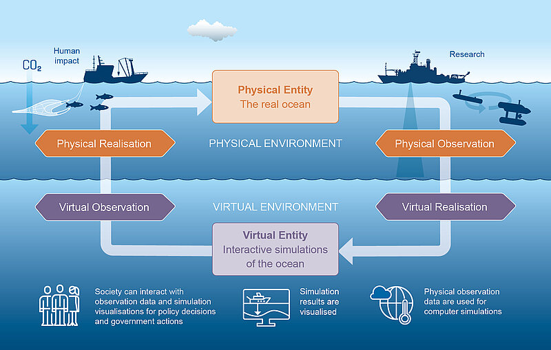
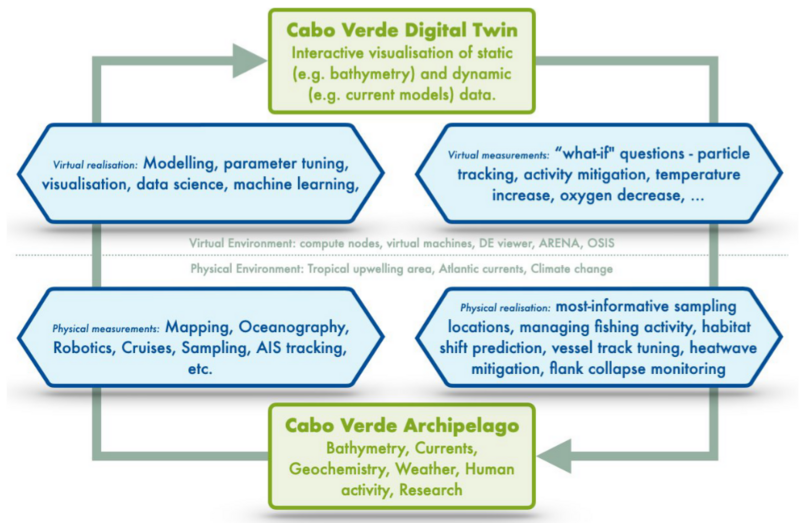
A digital twin consists of a virtual entity (simulations of the ocean) that represents a physical entity (the real ocean), both of which are bi-directionally linked by connections that allow acting on each other. These connections consist of an observation (i.e. measuring) in the virtual or physical entity and the realisation of the observation result as an impact onto the corresponding entity. Both the virtual and physical entity exist in their respective virtual and physical environments and are subject to virtual and physical processes.
What are Digital Twins of the Ocean?
The virtual entity of an Ocean Digital Twin is most likely a model (e.g. physics-based, AI-based) which can be executed in a virtual process to run simulations. It is run in a virtual environment consisting of compute infrastructure (e.g. High-Performance Computing) and data sources (e.g. data lakes like PANGAEA) and interfaces. The physical entity is the ocean compartment or process that the model represents. The physical-to-virtual connection of an Ocean Digital Twin is most often based on ocean observations (i.e.metrology) that provide real – yet potentially error-prone – ground-truth data using sensors (e.g. from research cruises, remote sensing, cabled observatories, citizen science). Depending on the type of Ocean Digital Twin, the virtual realizationof this connection then may be managing the digital data but more importantly the act of influencing the model itself (e.g. model optimization, process mining) or the act of influencing the simulation process (e.g. parameter optimization, object tracking) or else. Either of these realizations can be conducted manually or automatically. Manual observations in the virtual entity most likely rely on the virtual process of interactive visualization (e.g. data plots, Geo-Infirmation Systems, Virtual/Artificial Reality) whereas automated observations may require virtual processes (e.g. data mining, APIs). The physical realization step in the virtual-to-physical connection of Ocean Digital Twins can be facilitated by human intervention (e.g. fisheries management, sampling strategy development, ocean governance, stakeholder engagement, designation of protected areas, cruiseplanning).
Why does GEOMAR need Digital Twins?
We see Digital Twins as a means to “embrace digital tools and allow them to influence the way we do science”, i.e. a digital form of research culture to bridge disciplines and combine various information sources (models, observation data, real time data, offline data, hypotheses). Digital Twins are a form of scientific method, and as such they must satisfy the demand to gain knowledge in a certain scientific field. Considering existing methods, they need to do so more efficiently, more reliably, or ideally represent the only available way of assessing a question alltogether. Thus, it is important to design the Twin starting from the perspective of the desired output, which should ideally be quantitative, objective and repeatable: i.e. the use of a Digital Twin must result in some concrete product. The Digital Twin IRF team believes that:
- Digital Twins will broaden research capabilities, boost research output andincrease visibility of excellence of team GEOMAR.
- Digital Twins depend on the digital cultural change and can act as a catalyst for it.
Which Ocean Digital Twins does the IRF team envision?
We do not see the one single Digital Twin of the Ocean that incorporates all currentknowledge. We see “Digital-Twinning” as a tool that needs to be tailored to specific scales. As part of the IRF team, we identified four scales and multiple use cases for each of these to begin with:
- Global scale (>103 km2): e.g. a lobal ocean current Digital Twin
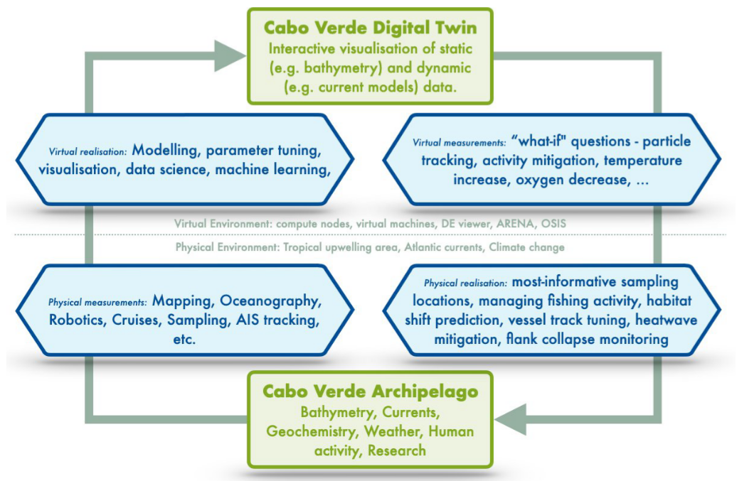
- Regional scale (101 – 103 km2): e.g. a Cabo Verde region Digital Twin, a Baltic Sea Digital Twin
- Local scale (10 m2– 101 km2): e.g. Munition dump sites, individual seamounts
- Micro scale (<10 m2): e.g. Microbiology, Symbionts, Microhabitats