Each layer a natural disaster
GEOMAR scientists present 3D seismic analyses of volcanic deposits offshore of the Caribbean island Montserrat
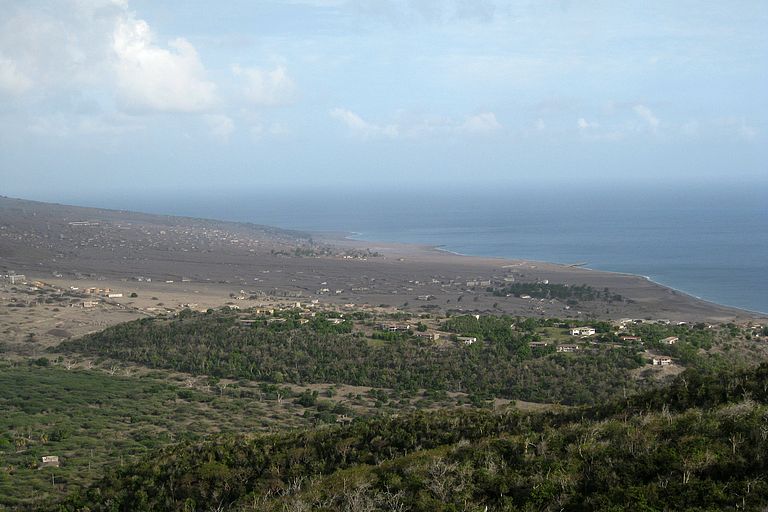
An entire city was buried in volcanic ash – for many, this statement brings to mind the ancient city of Pompeii. But even in very recent history, people have been forced from their homes and entire cities have been destroyed by volcanic activity. An example is the port city of Plymouth on the island of Montserrat. In 1995, the Soufrière Hills volcano in the centre of the island erupted after a dormancy period of approximately 300 years. In the two years to follow, numerous pyroclastic flows (extremely hot mixtures of blocks and ash moving at speeds of up to 100 km/h) cascaded down the slopes of the volcano and onto the city and its surroundings. In 1997, the authorities abandoned Plymouth and declared the entire southern half of the island of Montserrat an exclusion zone. Soufrière Hills has remained very active to the present day.
This on-going sequence of eruptions offers scientists the opportunity to learn more about the behaviour of volcanoes and their associated natural hazards. An expedition aboard the British research vessel RRS James Cook in May of 2010 was targeted at improving this understanding. Volcanic deposits offshore of the east coast of the island were mapped out during this research cruise. Some of these deposits were emplaced during the most recent eruptive phase, while others were deposited thousands of years ago. For the detailed mapping, GEOMAR’s further-developed P-Cable system was mobilised in the first ever deployment for this type of investigation. The system produces high-resolution, three-dimensional images of the sub-seafloor. A team of geophysicists from GEOMAR, under the leadership of Prof. Dr. Christian Berndt, were responsible for acquisition and processing of data with this equipment. The Kiel-based scientists have presented the results of this work together with their British colleagues in publications that have appeared in international journals since the beginning of the year. „Thanks to 3D technology, we were able to develop a much better understanding of how volcanic material is deposited in the ocean and which processes play key roles in this emplacement“, summarises Professor Berndt of the individual analyses.
A good understanding of these processes is particularly important for hazard assessment because volcanoes do not only pose a threat when they erupt material directly over populated areas. „Through the course of their existence, parts of the Soufrière Hills volcano have broken off and slipped into the sea. Some of the older landslides had volumes in excess of five cubic kilometres and moved more than ten kilometres through the ocean. They also very probably caused tsunamis“, explains Professor Berndt. Indeed, even smaller volcanic flank collapses have the potential to generate tsunamis. In 2013, a pyroclastic flow that resulted from a partial collapse of the volcanic dome caused a tsunami that was 15 m high on the east coat of Montserrat and still one meter high when it reached the neighbouring island where it destroyed several fishing boats.
With the help of 3D seismic data, the Kiel-based scientists were able to distinguish between various offshore deposits and their temporal evolution better than would have been possible with previously employed scientific methods. Their data enabled them to closely observe bounding layers between individual deposits and the seafloor. „We were surprised, for example, that pyroclastic flows that extend into the ocean have barely eroded the substrate beneath the seafloor onto which they were emplaced. This is markedly different behaviour from that which we know of pyroclastic flows on land“, explains the geophysicist Jens Karstens from GEOMAR. „In contrast to that, the much larger flank collapses can be highly-erosive, which could lead to more rapid deceleration and thereby smaller tsunamis than what has been previously assumed“, adds his colleague Dr. Gareth Crutchley.
The insight that the scientists have gained into the behaviour of volcanic deposition into the ocean does not only help to unravel the history of the Soufrière Hills volcano. „Our 3D data can also be used to calibrate geological computer models with which one can better predict the potential future hazards of island volcanoes“, explains the leader of the research group Professor Berndt. „In this respect, our seismic system has proven itself as a worthwhile tool for volcanic research“.
References:
Crutchley, G.J., J. Karstens, C. Berndt, P.J. Talling, S.F.L. Watt, M.E. Vardy, V. Hühnerbach, M. Urlaub, S. Sarkar, D. Klaeschen, M. Paulatto, A. Le Friant, E. Lebas, F. Maeno (2013): Insights into the emplacement dynamics of volcanic landslides from high-resolution 3D seismic data acquired offshore Montserrat, Lesser Antilles. Marine Geology, Vol. 335, http://dx.doi.org/10.1016/j.margeo.2012.10.004
Karstens, J., G.J. Crutchley, C. Berndt, P.J. Talling, S.F.L. Watt, V. Hühnerbach, A. Le Friant, E. Lebas, J. Trofimovs (2013): Emplacement of pyroclastic deposits offshore Montserrat: Insights from 3D seismic data. Journal of Volcanology and Geothermal Research, Vol. 257, http://dx.doi.org/10.1016/j.jvolgeores.2013.03.004
Images in higher resolution:
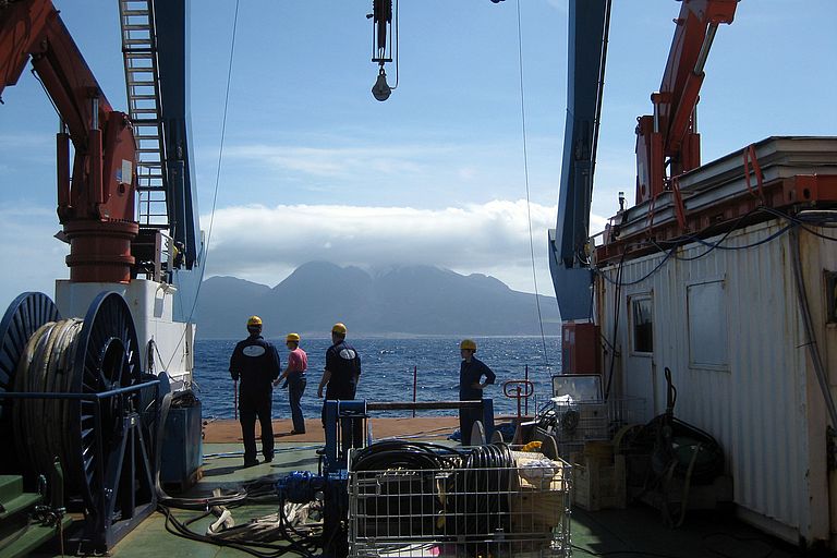
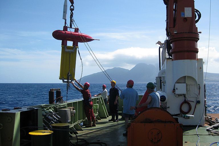
Launch of the P-Cable 3d seismic system during cruise JC45 off the coast of Montserrat. Photo: J. Karstens, GEOMAR
In the background the Soufrière Hills volcano. Photo: J. Karstens, GEOMAR
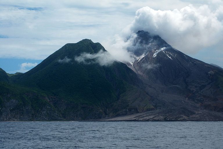
At the foot of Soufrière Hills deposits of pyroclastic flows are visible. Photo: J. Karstens, GEOMAR
Plymouth, the capital of the island of Montserrat, is buried in volcanic ash. Photo: J. Karstens, GEOMAR
Contacts:
Jan Steffen (GEOMAR, Communication and Media), Tel.: +49 431 600-2811, jsteffen(at)geomar.de


