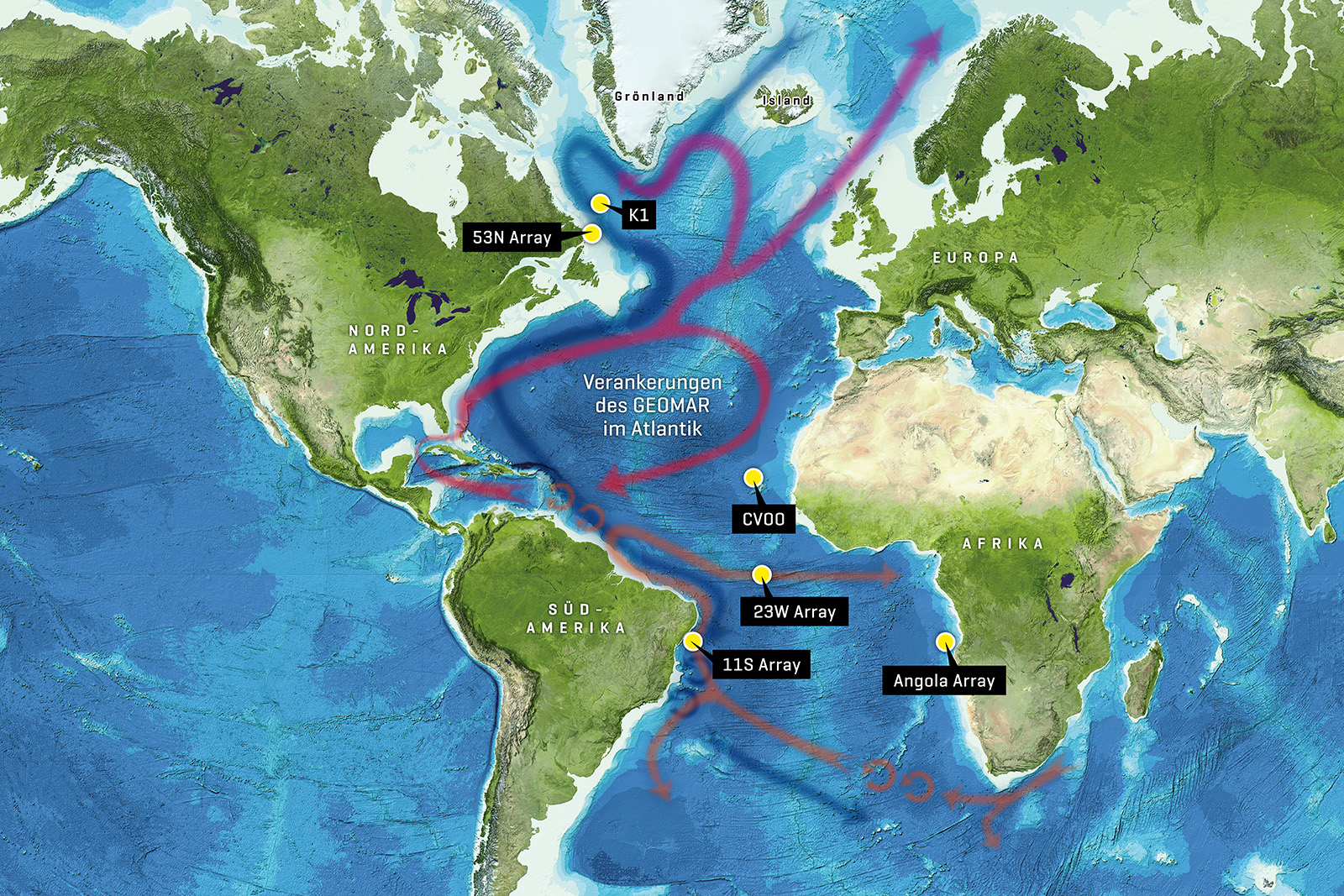
Map of the oceanographic moorings in the Atlantic managed by GEOMAR, showing the currents of warm surface water and cold deep water associated with the Atlantic Meridional Overturning Circulation (AMOC). During the M142 expedition, maintenance will be carried out on the 53°N Observatory and K1 mooring.
Graphic: Christoph Kersten/GEOMAR, Background: GEBCO
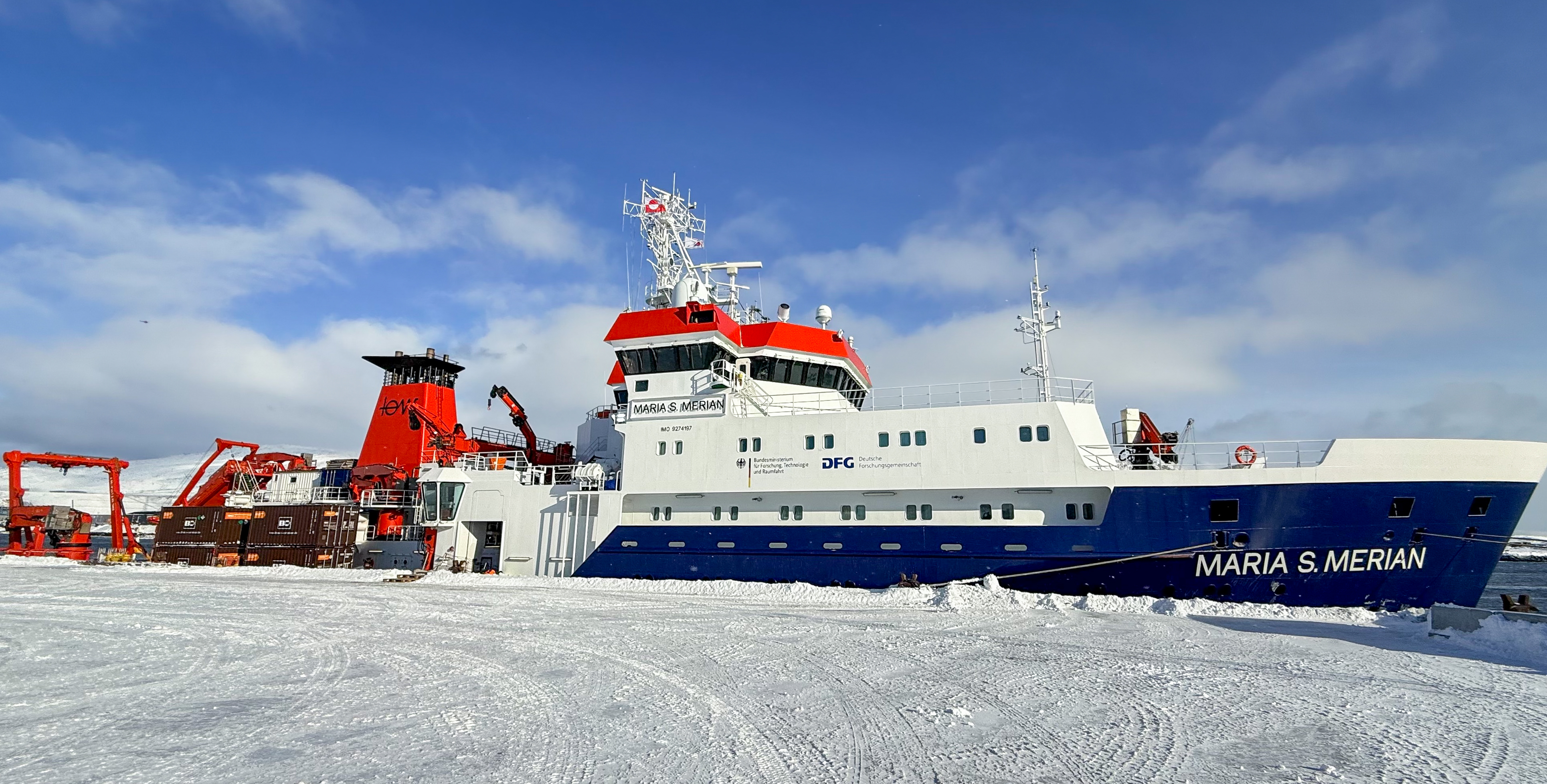
On Friday, the MSM142 expedition set sail from Nuuk (Greenland) on the research vessel MARIA S. MERIAN, heading for the Labrador Sea. The expedition combines research into the spring bloom in the Labrador Sea with long-term observations of large-scale ocean currents.
Photo: Fehmi Dilmahamod, GEOMAR
Plankton Bloom in the Labrador Sea
Research expedition MSM142 investigates dynamics in the subpolar North Atlantic
When the Ocean “Blooms” in Spring
In spring, the Labrador Sea between Greenland and Canada enters an important phase of the year: billions of microscopic algae multiply rapidly and form a vast phytoplankton bloom. In satellite images, this phenomenon appears as a green-blue discoloration of the ocean surface. The plankton bloom forms the basis of many marine food webs and at the same time acts as a carbon sink, helping to remove CO2 from the atmosphere.
But what role do small-scale structures such as fronts, filaments, or eddies play—flow features that extend over only a few kilometers and often exist for just a few days? This question is the focus of the research cruise, MSM142, under the leadership of Dr Fehmi Dilmahamod, physical oceanographer at GEOMAR Helmholtz Centre for Ocean Research Kiel.
Small Structures with a Large Impact
In the North Atlantic, the so-called small-scale physical processes occur frequently—including eddies, fronts, and filaments in the water. Although they are relatively small, they have major effects on the ocean by driving strong vertical motions, with water rising from the depths and surface water sinking. “Our goal is to capture these structures in the ocean, as a three-dimensional picture. For this purpose, we deploy a fleet of autonomously diving measurement platforms, so-called underwater gliders, that move through and across these features in order to observe them in as much detail as possible,” says expedition leader Fehmi Dilmahamod.
“These structures can act like mini-storms, rapidly mixing heat, nutrients and carbon,” explains Fehmi Dilmahamod. “They can bring water up from the depths or cause surface water to sink. In doing so, they shape the local environment and influence how and where phytoplankton blooms develop. With our expedition, we want to investigate more precisely how these small-scale structures inflence the spring bloom in the Labrador Sea—so far, we still know too little about this.”
Satellite data provide indications of where such structures occur. At sea, the research vessel then heads to these regions. There, the researchers study these features with an entire array of instruments:
• CTD probes record temperature, salinity, and oxygen content of the water.
• A Moving Vessel Profiler provides high-resolution profiles of the water column.
• Current meters (Acoustic Doppler Current Profiler, ADCP) determine the speed of water movements.
• Autonomous gliders and Argo floats collect additional data over several days or weeks and create three-dimensional picture of these features.
Alongside physical measurements, the team also analyzes water samples for dissolved inorganic carbon, alkalinity, and dissolved organic substances.
Observation of a Key Current System
Another part of the expedition leads to one of the most important long-term climate time-series: the 53°N Observatory at the exit of the Labrador Sea. For almost three decades, researchers have been observing the so-called Deep Western Boundary Current here. This current transport cold deep water southward and forms an important part of the Atlantic Meridional Overturning Circulation (AMOC).
During MSM142, the researchers will recover several deep-sea moorings, service the instruments, and redeploy them. The instruments were last checked and deployed in June 2024, and the data collected since then will now be retrieved. “These data will help us understand the Deep Western Boundary Current, track changes, and see how it connects to the AMOC. Many processes in the ocean occur on a scale of just a few kilometres, but can influence the large-scale currents and ecosystems of the global ocean,” says Fehmi Dilmahamod.
At the same time, the team is working on the K1 mooring in the central Labrador Sea. Similary, this mooring and its instruments need to be recovered, serviced and redeployed. Researchers are studying processes of deep convection there – that is, when surface water cools significantly in winter and sinks to great depths.
Expedition at a Glance:
Name: M142 (Submesoscale experiment analysing the North Atlantic Spring Bloom in the Labrador Sea, SEA-Bloom / Climate observatories in the western subpolar North Atlantic, ClimObsSPNA / Durchmischung und Sedimentdynamik, MIXSED-1)
Duration: 27 March 2026 to 11 May 2026
Expedition leader: Dr Fehmi Dilmahamod
Start: Nuuk (Greenland)
End: Reykjavik (Iceland)
Expedition area: North Atlantic
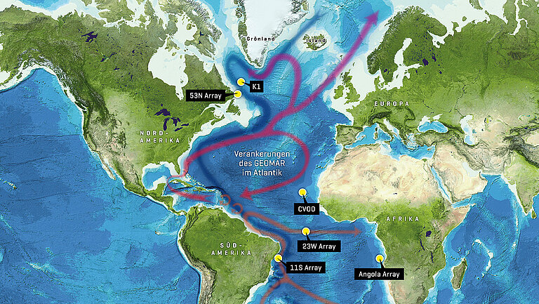
Map of the oceanographic moorings in the Atlantic managed by GEOMAR, showing the currents of warm surface water and cold deep water associated with the Atlantic Meridional Overturning Circulation (AMOC). During the M142 expedition, maintenance will be carried out on the 53°N Observatory and K1 mooring.
Graphic: Christoph Kersten/GEOMAR, Background: GEBCO
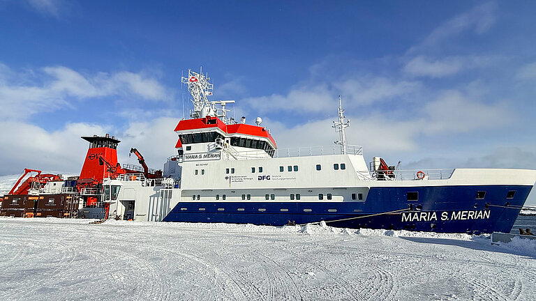
On Friday, the MSM142 expedition set sail from Nuuk (Greenland) on the research vessel MARIA S. MERIAN, heading for the Labrador Sea. The expedition combines research into the spring bloom in the Labrador Sea with long-term observations of large-scale ocean currents.
Photo: Fehmi Dilmahamod, GEOMAR