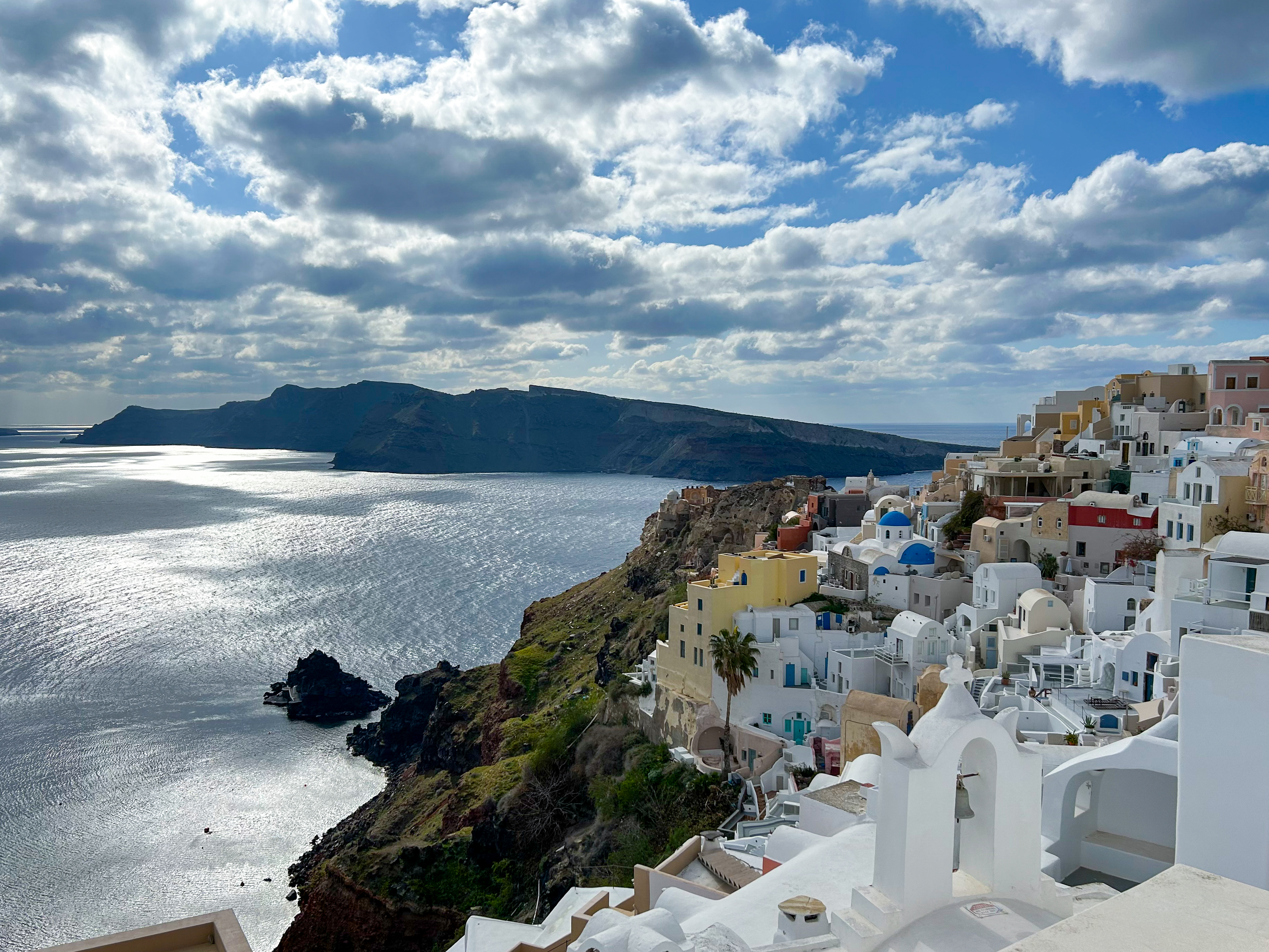
Santorini is located in the eastern Mediterranean Sea and is part of the Hellenic volcanic arc, a geologically highly active zone.
Photo: Jens Karstens, GEOMAR

Seismic measurements during the MSM132 expedition in December 2024.
Photo: Andrea Geipel, GEOMAR

One highlight is the use of the MOMO video sledge. The camera system was developed at GEOMAR last year and enables millimetre-precise mapping of the seabed.
Photo: Andrea Geipel, GEOMAR
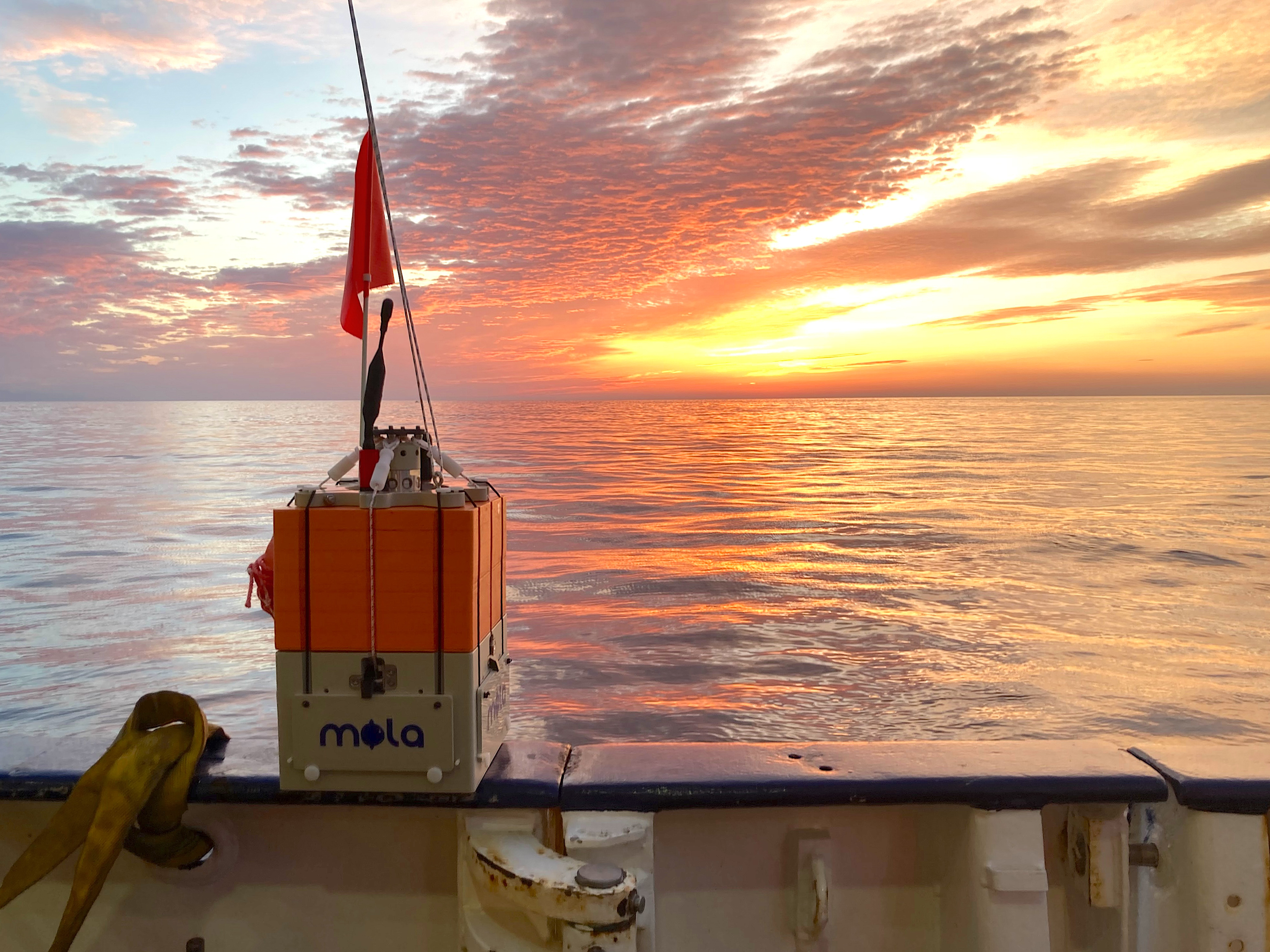
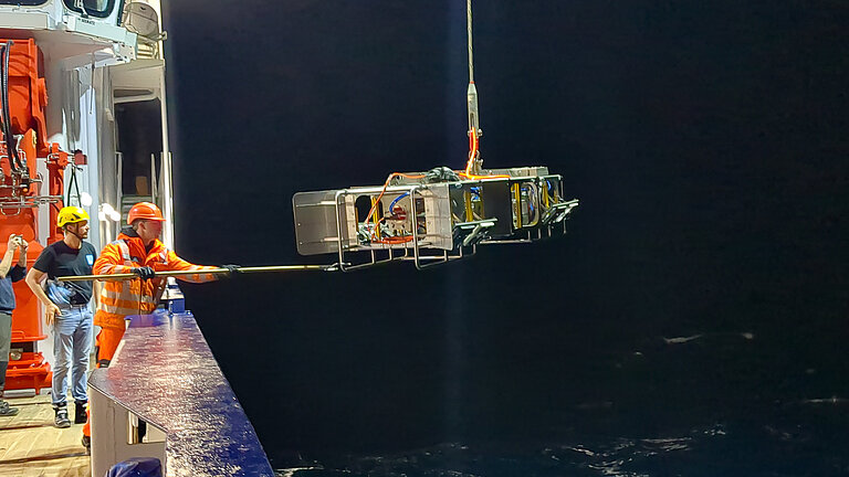
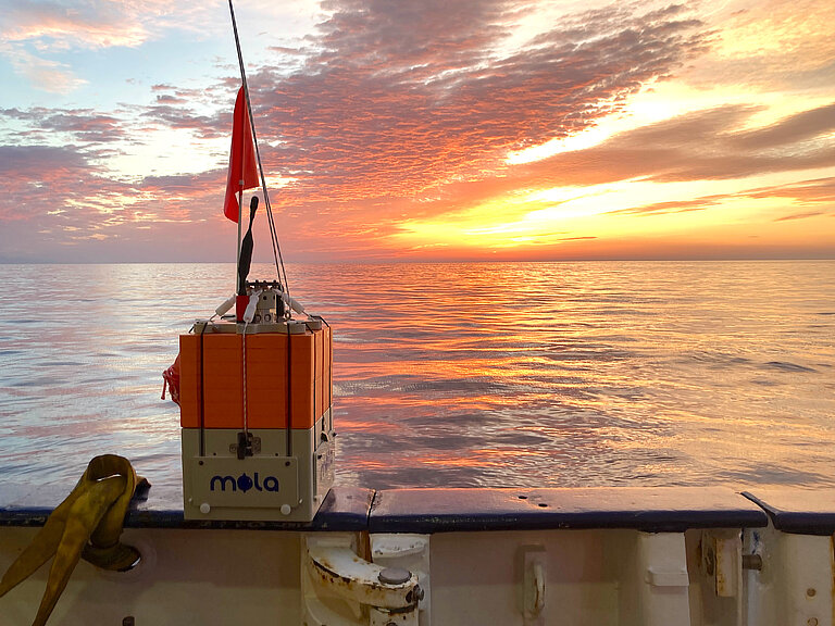
In order to test a long-term observation network, the researchers will conduct tests and communication experiments using MOLA (Modular Ocean Lander) systems, among other things.
Photo: Jens Karstens, GEOMAR
Better Understand the Volcanic System Around Santorini
Expedition M215 tests new monitoring systems
At the beginning of 2025, the Greek Santorini archipelago was in a state of crisis: over several weeks, more than 28,000 earthquakes were recorded there. Santorini is located in the eastern Mediterranean and is part of a geologically highly active zone. The archipelago forms the rim of a volcanic caldera (a cauldron-shaped crater) that was created around 3,600 years ago by a massive volcanic eruption. Seven kilometres northeast of Santorini is the active undersea volcano Kolumbo. It is part of a chain of more than 20 underwater volcanoes that form the Santorini-Kolumbo volcanic field. At the same time, Santorini attracts up to three and a half million tourists annually, making it one of Greece's most important tourist destinations.
Assessing the situation after the seismic crisis
Back in December 2024, an international research team led by the GEOMAR Helmholtz Centre for Ocean Research Kiel was already working off the coast of Santorini as part of the MULTI-MAREX research project to understand the geological processes that can trigger landslides, volcanic eruptions and tsunamis. A few weeks later, the earthquake swarm began in this region. GEOMAR researchers were also on site during the crisis and were able to collect valuable data.
"From a scientific point of view, we are currently in a unique situation. We were able to take measurements and deploy sensors immediately before and during the seismic crisis around Santorini. Expedition M215 will now analyse the situation immediately after the crisis. We have optimal conditions for comparing data and repeating our experiments. This enables us to draw conclusions that would otherwise have taken many years or even decades," says Jens Karstens, marine geophysicist at GEOMAR and co-expedition leader.
Improving the early warning system
Joint analysis of data by researchers from GEOMAR and the GFZ Helmholtz Centre for Geosciences has shown that the earthquake swarm at the beginning of the year was triggered by the transport of magma at depth. With the current M215 expedition, the researchers want to gain an even better understanding of how volcanic systems react and what possible scenarios could arise in the future.
The overall goal is to test a new monitoring system and thus improve early warning of other earthquakes in the future. The current early warning system is based primarily on GPS-based systems and seismometers on land that can detect the smallest deformations and tremors in the ground. "The early warning systems on land are very sensitive and work reliably. However, we want to go one step further and reliably detect what is happening on the seabed even before the tremors occur. To this end, we are also in close contact with the Greek government. The aim is to be able to better assess the coastal hazard," says expedition leader Prof. Dr. Heidrun Kopp, Professor of Marine Geodesy at GEOMAR and project manager of MULTI-MAREX.
Another focus of the research is to assess the stability of volcanic structures. "We want to know: How do the volcanic slopes in the Santorini-Kolumbo volcanic field behave when tectonic activity occurs?" explains Heidrun Kopp.
Testing a communication network
During the expedition, the researchers will collect and install measuring stations and carry out geophysical measurements. In order to test a long-term observation network, the researchers will conduct tests and communication experiments with so-called MOLA systems (Modular Ocean Lander). Jens Karstens: "MOLA systems are compact, small measuring devices that can detect deviations on the seabed, such as noise, temperature changes or changes in CO2 concentrations. The systems communicate with each other, and we are working with data analysts to test how the data can be transmitted to land in real time." The researchers are testing the functionality of a communication network that communicates between anchored devices, the ship and a cloud and could thus be used for early warning in the long term.
One highlight is the use of the MOMO video sledge. The camera system was developed at GEOMAR last year and enables millimetre-precise mapping of the seabed. In December 2024, immediately before the seismic crisis, the hydrothermal systems in the crater of the Kolumbos volcano and within the Santorini caldera were surveyed using the MOMO video sled. The measurements are now being repeated. This will allow the dynamic changes in both systems to be compared in detail. This data will also be incorporated into the development of the observation network.
In addition, ocean bottom seismometers (OBS) have been recording acoustic signals and pressure on the seafloor since December 2024, thus also recording the magma movements during the earthquakes in January 2025. The research team is deploying five new OBS stations on the seafloor for a further twelve months. In addition, the researchers are deploying up to 20 MOLAs for around 15 days and installing OBMT (Ocean Bottom Magnetotelluric) stations that record changes in electric and magnetic fields. This data shows how well the rock conducts electricity – and thus also where liquids, rising magma or warm hydrothermal currents are hidden. In addition to the autonomous underwater vehicles (AUVs) ANTON and KALLE, drone flights and surveys with multibeam echo sounders and beam echo sounders are also planned.
Expedition at a Glance: M215
Name: M215 (MULTI-MAREX Cruise 3)
Chief Scientist: Prof. Dr. Heidrun Kopp
Dates: 17 December 2025 – 10 January 2026
Departure: Heraklion (Greece)
Arrival: Limassol (Cyprus)
Working Area: Mediterranean Sea, Aegean Sea
Background: MULTI-MAREX
MULTI-MAREX is one of four projects within the research mission ‘Ways to improve risk management in the field of marine extreme events and natural hazards’ (mareXtreme), which is being implemented by the German Marine Research Alliance (DAM). It brings together ten partner institutions from six universities and the two Helmholtz Centres GFZ and GEOMAR in Germany. The aim is to develop a real-world laboratory for investigating geomarine extreme events such as earthquakes, volcanism and tsunamis in the central Mediterranean region.
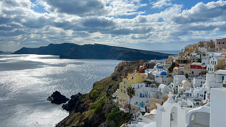
Santorini is located in the eastern Mediterranean Sea and is part of the Hellenic volcanic arc, a geologically highly active zone.
Photo: Jens Karstens, GEOMAR
Seismic measurements during the MSM132 expedition in December 2024.
Photo: Andrea Geipel, GEOMAR
One highlight is the use of the MOMO video sledge. The camera system was developed at GEOMAR last year and enables millimetre-precise mapping of the seabed.
Photo: Andrea Geipel, GEOMAR
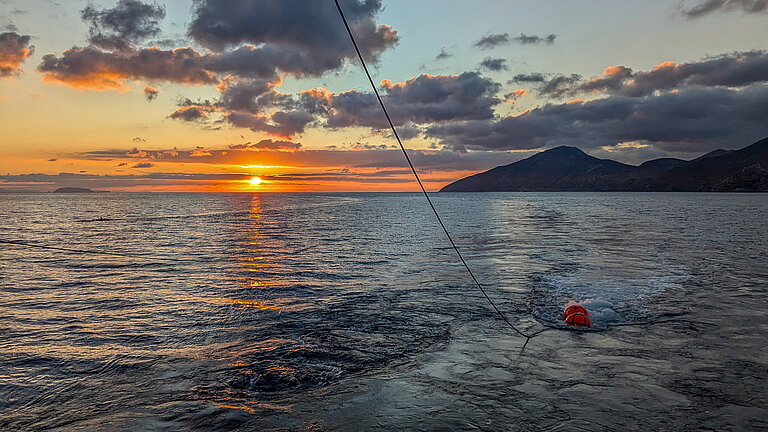
In order to test a long-term observation network, the researchers will conduct tests and communication experiments using MOLA (Modular Ocean Lander) systems, among other things.
Photo: Jens Karstens, GEOMAR