Why did Gondwana break up?
Marine Geophysicist start an expedition to the most remote island in the world
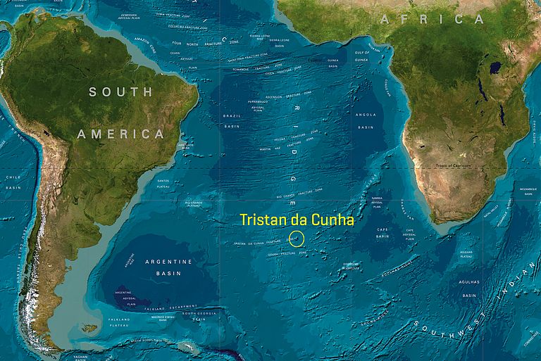
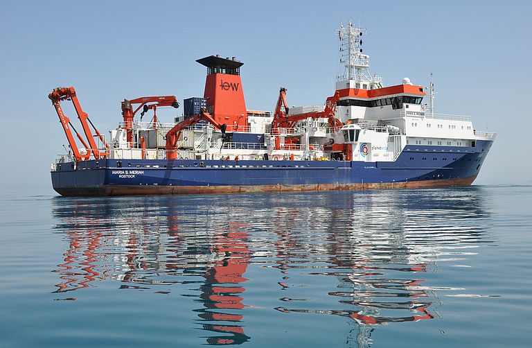
The island of Tristan da Cunha consists of a single volcano with a diameter of 12 kilometres. It has a population of 300 and lies more than 2500 kilometres away from the next inhabited land in the middle of the southern Atlantic. Therefore it’s often called the most remote inhabited island in the world. However, that is not the only reason why scientists are fascinated by Tristan da Cunha and its smaller, uninhabited, neighbouring islands. The origin of the archipelago is closely connected with the breakup of the Gondwana supercontinent 120 million years ago. But what happened exactly is still controversial. „Although the region is important for the understanding of plate tectonics in general, there are far too few geophysical data from Tristan da Cunha“, says Dr Marion Jegen from GEOMAR | Helmholtz Centre for Ocean Research Kiel. She is chief scientist of an expedition to the archipelago conducted with the German research vessel MARIA S. MERIAN in January and February 2012. Its aim is to collect new data in order to answer some of the open questions concerning the breakup of Gondwana and the forming of the southern Atlantic.
Currently, two theories are being discussed. According to the classical plume theory, Tristan da Cunha is a volcanic hotspot. The hotspot played a major role in the rifting of the South Atlantic margins and the creation of the aseismic Walvis Ridge by impinging at the base of the continental lithosphere shortly before or during the breakup of the South Atlantic margins. “The problem is that Tristan da Cunha cannot be clearly identified as a hotspot”, Marion Jegen explains. The second theory therefore classifies Tristan da Cunha as a more shallow type of anomaly that may actually have been a result of the Gondwana breakup and not the reason for it.
To check these theories the scientists onboard the RV MARIA S. MERIAN will implement a multi-disciplinary geophysical study of the region by acquiring marine electromagnetic, active and pas-sive seismics as well as gravity and bathymetric data. „In this way we want to identify the crustal structure and temperature and partial melt anomalies in the upper mantle to understand the tectonic processes of the opening of the South Atlantic and the formation of the Walvis Ridge”, says Marion Jegen.
In addition to the scientific work the MARIA S. MERIAN also provides logistical support for the inhabitants of Tristan da Cunha. The German research vessel will deliver mail and three British engineers whose task will be to repair damaged port facilities of the settlement “Edinburgh of the Seven Seas”. „Tristan da Cunha is only serviced by fishing vessels every two months. The Royal Mail ship Saint Helena drops anchor there twice a year. Thus the administration is happy about every additional ship calling in Tristan. And of course we’re glad to help“, stresses Dr Jegen.
Expedition at a glace:
FS MARIA S. MERIAN cruise: MSM 20/2
Chief scientist: Dr Marion Jegen (GEOMAR)
Duration: 17 Jan 2012 – 15 Feb 2012
Departure: Walvis Bay (Namibia)
Working area: Tristan da Cunha
Final port: Recife (Brasil)
Current reports from the cruise you find in the internet on the GEOMAR-expedition pages an the ISOLDE project pages.
Contact:
Jan Steffen (Communication & Media), Phone: +49-431 600 2811, presse(at)geomar.de


