Nemesys
Variabilität von submarinen Gasaustritten in Struktur und Chemie und deren Klimarelevanz – Hikurangi Margin Neuseeland
Duration: 01.01.2011 - 28.02.2013
Coordinator: Dr. Jörg Bialas
Project leader GEOMAR: Dr. Jörg Bialas
Sponsored by: BMBF (Federal Ministry of Education and Research), cooperative project with BGR Hannover (Federal Institute for Geosciences and Natural Resources)
Active Seeps at the Hikurangi Margin exhibit a strong variability. Geochemical and geophysical methods will be employed to investigate the known seeps in more detail. Previous knowledge about these variations will be augmented by using dense nets of sensors and 3-D measurements. New seismic techniques (P-Cable 3-D, DeepTow), electromagnetic profiles, a 3-D grid of combined sensor and geochemical methane analyses in the water column and hydroacoustic 3-D-flare imaging is planned. Besides the short-term-measurements during the cruise, the comparison with earlier cruises (SO-191, RV TANGAROA) will provide additional information to study long-term variations. Seeps along the Hikurangi Margin are not only influenced by tectonic variations, but occur in very different water depths. With Dr. Schwalenberg (BGR) as our partner, the acquisition of marine electromagnetic data is possible, which will lead to more detailed information on hydrate distribution, especially in combination with seismic data.
Partners from the Netherlands (Dr. Greinert, NIOZ, Texel) and New Zealand (Dr. Stuart Henrys und Dr. Ingo Pecher, GNS, Lower Hutt) will be cooperating during the duration of the project.
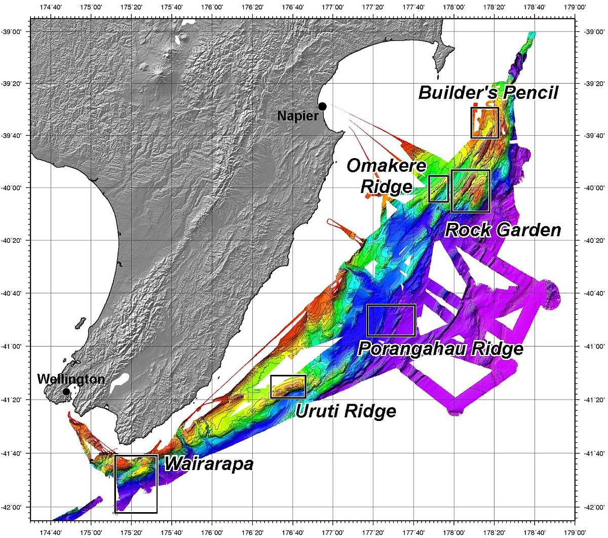
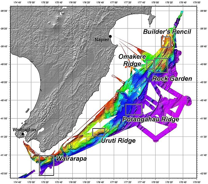
Working area
Overview of the six working areas which were studied during SO191. Four of these areas (Wairarapa, Uruti Ridge, Porangahau Ridge and Rock Garden) will be investigated again during the NEMESYS project. The underlayed bathymetric map is a summary of the recorded bathymetric data during the expeditions TAN0607, TAN0616 and SO191 (EM300, EM120)
