Image of the month: July 2020
Drone monitoring at Stromboli
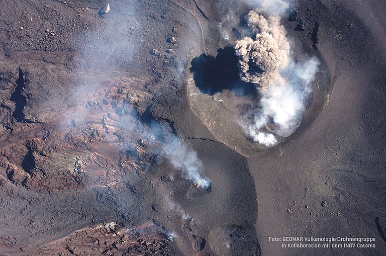
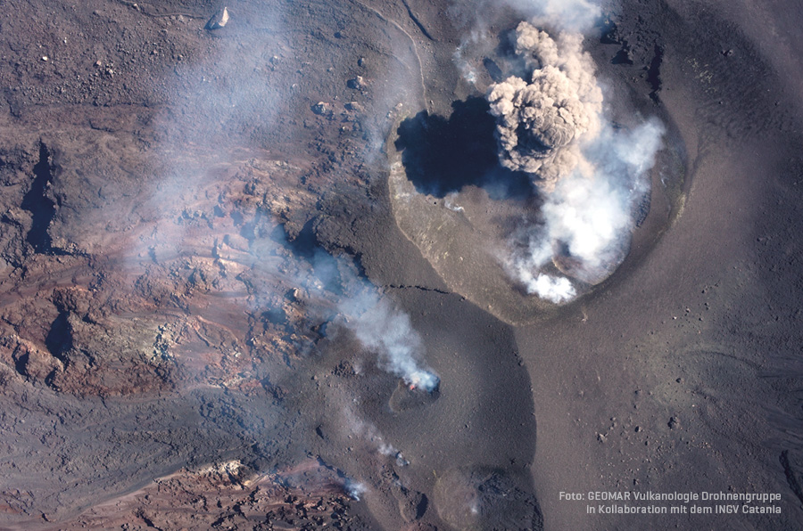
Our image of the month shows the volcano Stromboli, which forms the island of the same name in the Mediterranean Sea north of Sicily.. Together with its neighbouring islands it belongs to the group of the Aeolian Islands, also called Lipari Islands. The visible part of Stromboli rises 924 meters from sea level, but from the sea floor the height of the volcanic cone is about 3000 meters. The image was created during a campaign by the GEOMAR drone group at Stromboli in September 2019, which was launched after two exceptionally large eruptions had occurred there in July and August 2019. During the campaign, which was carried out in cooperation with the volcanological institute INGV Catania, scientists flew to the volcano with drones to create new maps and monitor the current activity, thus supporting the local civil protection. The drone was in the right place at exactly the right time to take this image and was able to capture a small strombolian eruption next to the crater and the newly formed lava flow. These explosions last only a few seconds and the ash cloud is visible for a few minutes at most. Our image of the month thus impressively shows the permanent activity of the Stromboli, which continuously ejects ash and lava in short intervals, and shows why the volcano is under constant observation.