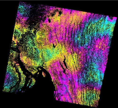
Interferogram (InSAR) of the Myanmar-Bangladesh region: The coloured fringes show changes in distance to the satellite between two acquisitions — the closer the fringes, the greater the change. Water bodies, such as rivers and the sea, appear black. Many such interferograms can be combined to produce an annual ground-motion map.
Photo:
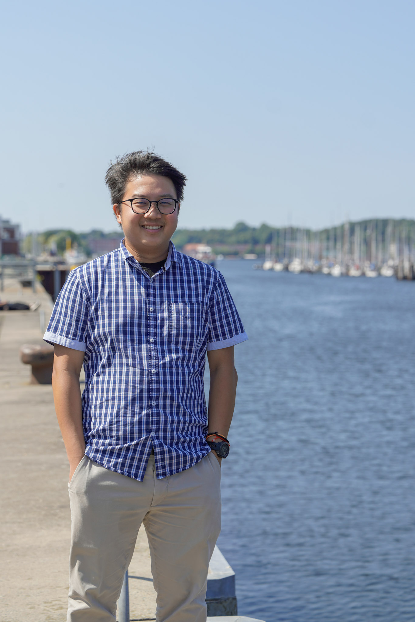
Geoscientist Dr Jeng Hann Chong is spending two years as a Humboldt Fellow at GEOMAR. He uses satellite imagery to study earthquake-prone areas.
Photo: Pia Steinke, GEOMAR
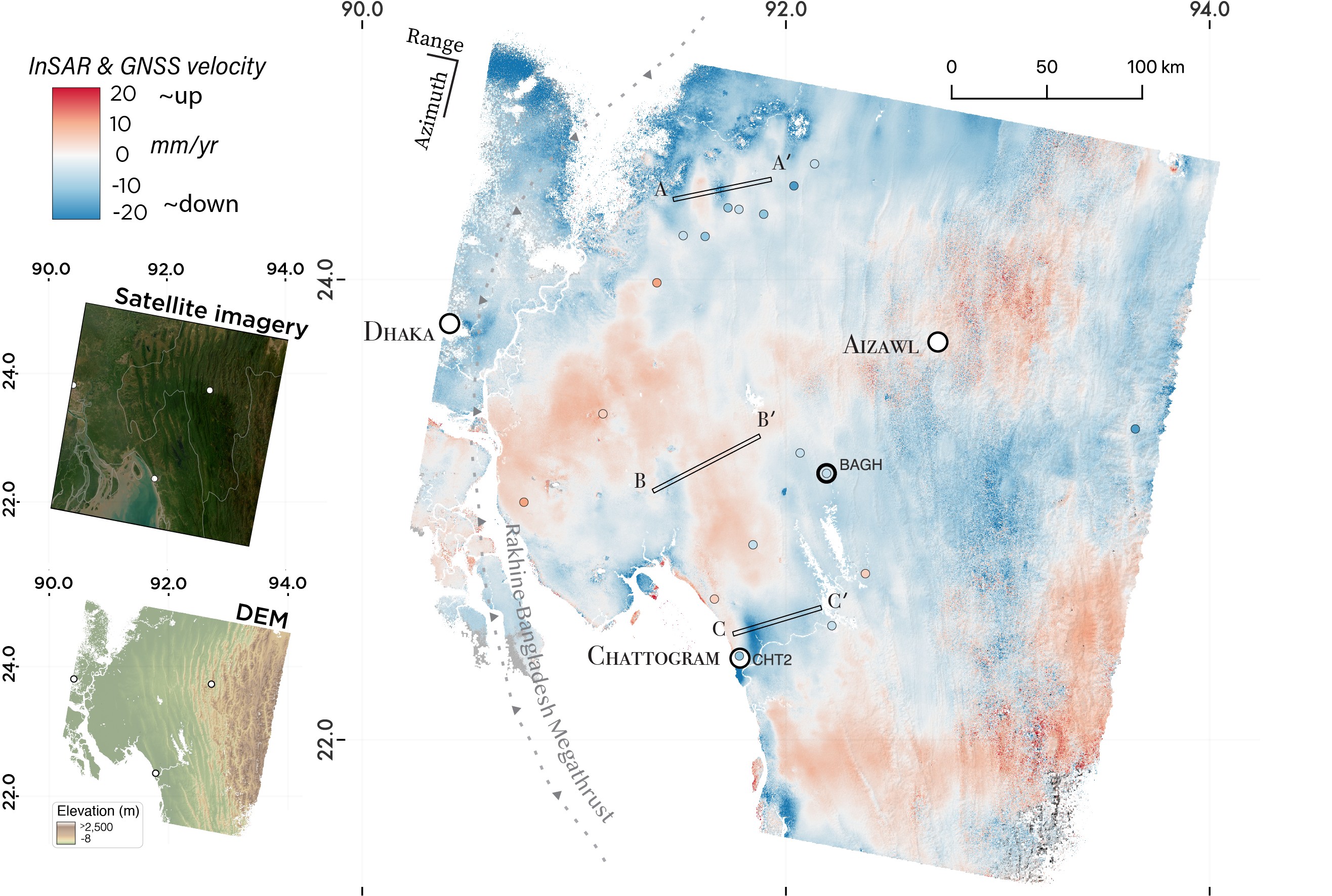
Ground deformation map of the Myanmar-Bangladesh border region (2015-2022): The map shows the annual rate of ground movement from InSAR during a period without major earthquakes. Colours indicate motion along the satellite’s line of sight, showing where the ground rises or sinks. Coloured circles are GNSS velocities projected into the same line of sight and plotted on the same colour scale. A dashed line marks the Rakhine–Bangladesh megathrust. Insets show a satellite image and the area’s elevation.
Illustration: Chong, 2024.
A view of the Earth’s dynamics from space
As a Humboldt Fellow, Dr Jeng Hann Chong is researching active fault zones and natural hazards at GEOMAR
The seabed is dynamic. Where, when and exactly how these movements occur is being investigated at GEOMAR in the Marine Geodynamics research unit. However, tectonic forces do not stop at the coastline, and so Dr Jeng Hann Chong’s research fits perfectly into the vast data puzzle that is being worked on collaboratively here. Since 1 April, as a Humboldt Fellow, he has been contributing his unique perspective: he observes the Earth from space to detect ground movements and uses modelling to identify active fault zones and better assess natural hazards.
An earthquake shaped his path
Jeng Hann Chong was born in Malaysia, a country considered seismically stable as it lies far from plate boundaries. When a magnitude 6.0 earthquake struck the island of Borneo in 2015 – the north-western part of which belongs to Malaysia – his belief in his country’s supposed safety from earthquakes was also shaken. “The earthquake inspired me to study geology.” He completed his bachelor’s degree at the University of Maryland on the US East Coast, before moving to the West Coast, to California State University Northridge in Los Angeles, California, to pursue a master’s degree in geophysics. This was followed by a PhD at the University of New Mexico, with a thesis on ‘The integration of satellite observations and modelling approaches to investigate tectonic and surface-related natural hazards’.
He had already met his host in Kiel, Prof. Dr Laura Wallace, back in 2018 at a conference of the American Geophysical Union (AGU). “I was still an undergraduate. She looked at my poster – and when I saw her again in 2024 at a workshop in Colorado, she actually still remembered me and the work I presented,” says Chong. During that reunion, the idea arose to apply for a research fellowship from the Alexander von Humboldt Foundation to further his work in Germany.
Making active faults visible
He is now spending two years at GEOMAR studying faults on land and in subduction zones – regions where one tectonic plate dives beneath another that can produce large earthquakes. These zones not only shape the seabed; they are also closely linked to fault and fracture systems on land, which can trigger earthquakes, landslides or slow ground movements.
“I work with satellite images and look at how the Earth is changing,” says Chong. He compiles mosaics from many individual images, in a process called Interferometric Synthetic Aperture Radar (InSAR), which reveal changes over time. It is not a single image that is crucial here, but the series: what is changing? Which structures are active? These time series can indicate how much ‘potential’ lies within a system, where stresses are building up and this information can be used to analyze how risks vary spatially.
Satellite imagery, mosaics and high-performance computing
This approach is highly data-intensive. For his image processing and modelling, Chong uses the High-Performance Computer (HPC) at Kiel University. He is currently processing InSAR over southern Greece: a country characterised geologically by numerous faults. He hopes to be able to present his initial findings in October.
At GEOMAR, he enjoys the wide variety of research, which offers many links to his own work and potential collaborations. “Everyone here has given me a very warm welcome,” he says. This is certainly also down to his own friendly nature and his winning smile. He likes Kiel very much; his arrival here coincided with the start of spring, but over the next year and a half he will experience two Nordic winters, during which it will scarcely get light. He cannot quite imagine that at the moment, as he is currently enjoying the long days of the north. “Let’s see what awaits me there,” Chong says with a laugh.
Background: Humboldt Fellowship for Experienced Researchers
Each year, the Humboldt Foundation enables more than 2,000 researchers from around the world to undertake a research stay in Germany. The Foundation maintains a network of more than 30,000 Humboldt scholars worldwide across all disciplines in over 140 countries—including 63 Nobel laureates.
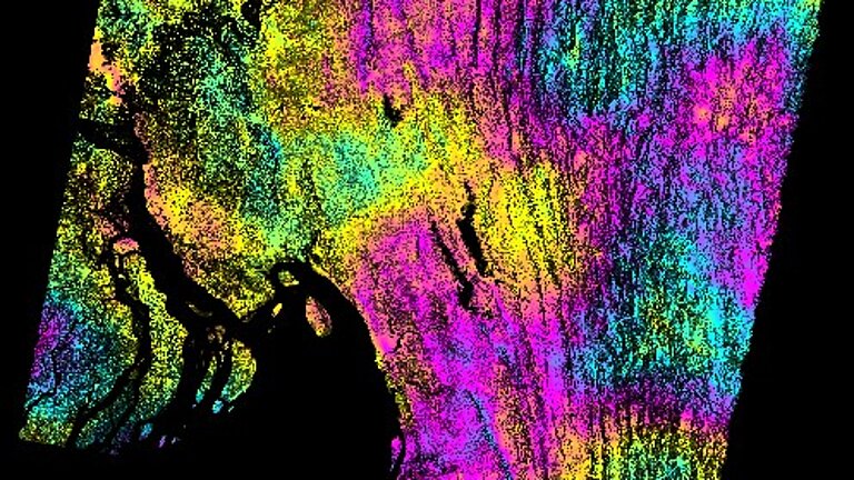
Interferogram (InSAR) of the Myanmar-Bangladesh region: The coloured fringes show changes in distance to the satellite between two acquisitions — the closer the fringes, the greater the change. Water bodies, such as rivers and the sea, appear black. Many such interferograms can be combined to produce an annual ground-motion map.
Photo:
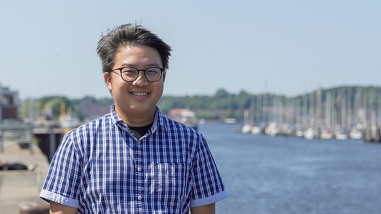
Geoscientist Dr Jeng Hann Chong is spending two years as a Humboldt Fellow at GEOMAR. He uses satellite imagery to study earthquake-prone areas.
Photo: Pia Steinke, GEOMAR
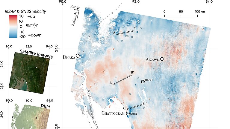
Ground deformation map of the Myanmar-Bangladesh border region (2015-2022): The map shows the annual rate of ground movement from InSAR during a period without major earthquakes. Colours indicate motion along the satellite’s line of sight, showing where the ground rises or sinks. Coloured circles are GNSS velocities projected into the same line of sight and plotted on the same colour scale. A dashed line marks the Rakhine–Bangladesh megathrust. Insets show a satellite image and the area’s elevation.
Illustration: Chong, 2024.