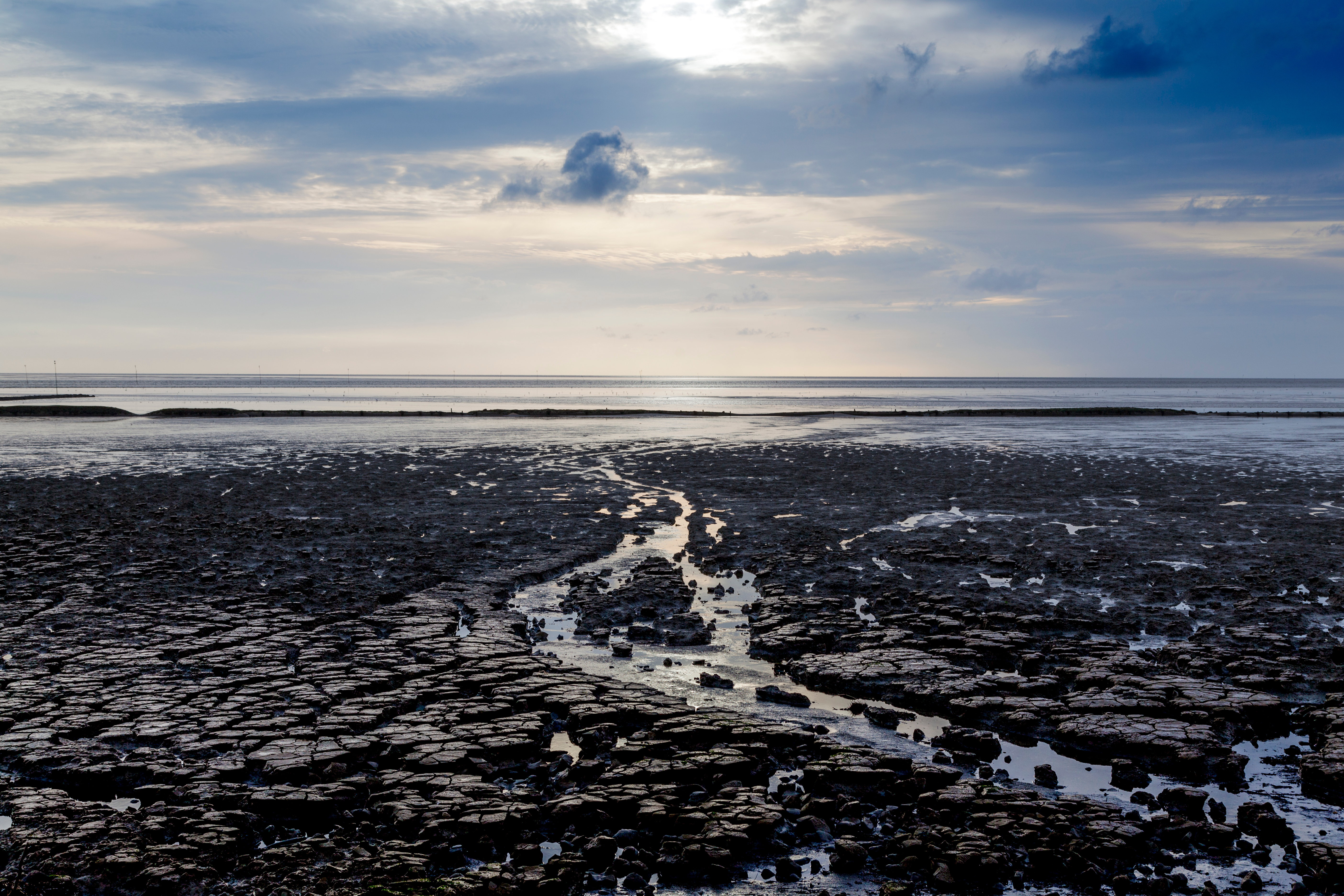
The Wadden Sea in Meldorf Bay: Here, as part of a joint measurement campaign, researchers are studying greenhouse gases. Their particular focus is on where methane is produced and how much of it enters the atmosphere.
Photo: Ralf Gosch, Adobe Stock

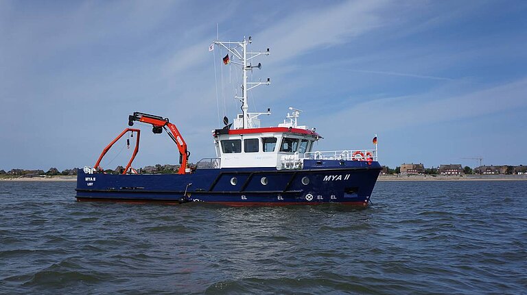
The MYA II is one of the vessels participating in the measurement campaign. An energy-self-sufficient measurement pontoon is also being used.
Photo: Florian Lange
Where does the methane in the Wadden Sea come from?
Research campaign investigates greenhouse gases in Meldorf Bay
Anyone looking out across the Wadden Sea at low tide probably doesn’t think of greenhouse gases as the first thing that springs to mind. Yet processes are constantly taking place in the sediment and in the water, during which carbon is converted and greenhouse gases are produced, absorbed or transported further. The extent of these material flows and which sources are significant has been little researched, particularly in coastal areas.
As part of a joint measurement campaign, scientists from six German research institutions are now investigating greenhouse gases in a measurement section established around Meldorf Bay: it begins close to shore at the outlet of the Meldorf Siel and runs along the shipping channel from Büsum to the open coast. Two research vessels – the MYA II and the LUDWIG PRANDTL – are taking part in the measurement campaign, along with an energy-self-sufficient measurement pontoon.
“The coast is the interface between land and ocean: here, carbon compounds are transformed, transported and released again with the tides within a short space of time,” says Dr Ingeborg Bussmann, a biogeochemist at the Alfred Wegener Institute (AWI) on Heligoland, who is coordinating the campaign. “We are particularly interested in where methane is produced and how much of it actually enters the atmosphere.”
The Wadden Sea campaign is a component of the ElbeXtreme project (a collaborative project within the research mission of the German Alliance for Marine Research, DAM), which addresses the impacts of extreme events in the Elbe estuary and the German Bight. The data from the campaign will be incorporated into the numerical modelling and the planned information and decision-support system of ElbeXtreme, thereby supporting risk understanding and resilience planning for coastal ecosystems and local communities.
“With the Wadden Sea campaign, we are filling a key knowledge gap: to what extent do mudflats that fall dry contribute to CO2, methane and nitrous oxide fluxes in extreme years such as 2026? By simultaneously sampling water, sediment and the atmosphere, we are creating the data foundation for realistic models and sound decisions on the protection and management of our coastal regions,” says Prof. Dr Eric Achterberg, professor in the Marine Biogeochemistry Research Division at GEOMAR Helmholtz Centre for Ocean Research Kiel and consortium leader of ElbeXtreme.
Where does the methane come from?
Previous measurements have repeatedly revealed elevated concentrations of dissolved methane near mudflat areas. However, it is still unclear where the gas originates. One possible source lies in the mudflat sediment. There, microorganisms break down organic material and may produce methane in the process. However, the gas could also enter the bay via groundwater from the sediments. Another possibility is inflows from the mainland, which enter the coastal waters via sluices. The measurements are intended to help distinguish between these different pathways. To this end, the researchers are analysing radon, amongst other things. This naturally occurring radioactive noble gas serves as an indicator of how much groundwater is entering the coastal waters. In addition, they are examining the water in the pores of the sediment – that is, the fluid between the individual sediment grains.
Three greenhouse gases, many pathways
In addition to methane CH4, carbon dioxide CO2 and nitrous oxide (N₂O) are also being monitored. It is not just a question of how much of a gas is present at a measuring point. Equally important is whether the gas is formed there, escapes from the water into the atmosphere, or is transported further with the water.
At the measuring stations at sea, the teams record, amongst other things, the temperature, salinity and turbidity of the water, and take samples to analyse for nutrients and various carbon compounds. On the mudflats that are exposed at low tide, they also measure directly how much greenhouse gas is released from the sediment into the atmosphere. In addition, they analyse volatile organic carbon compounds in the air. This provides as complete a picture as possible of the various material cycles between land, mudflats, water and the atmosphere.
What happens after a hot summer?
The campaign will also investigate whether the particularly hot and dry summer of 2026 leads to exceptionally high greenhouse gas levels – this is conceivable, as under such conditions a great deal of organic material can form and subsequently be broken down again. This process can result in the release of greenhouse gases. However, it will only be possible to assess whether this effect is actually reflected in the measurements once the campaign has concluded.
As this is the first time researchers have carried out such comprehensive measurements in this area, there is a lack of comparative data from previous years. The results will therefore initially focus on identifying which sources and transport pathways play a role in Meldorf Bay and how significant their respective contributions are.
Working together from the mainland to the open coast
Six German research institutes are taking part in the campaign: the Alfred Wegener Institute (AWI), the Helmholtz Centre Hereon, the Karlsruhe Institute of Technology (KIT), the Helmholtz Centre for Environmental Research (UFZ), the University of Hamburg and the GEOMAR Helmholtz Centre for Ocean Research Kiel.
The work is being carried out in close collaboration with the Schleswig-Holstein Wadden Sea National Park Authority, the district of Dithmarschen, the conservation area managers of the Speicherkoog Dithmarschen, the Federal Waterways and Shipping Administration, and the Büsum Research Centre.
The results of the campaign will be incorporated into the ElbeXtreme, AGRIO, CoastGem (ITMS), MOSES and MUSE projects.
The Wadden Sea in Meldorf Bay: Here, as part of a joint measurement campaign, researchers are studying greenhouse gases. Their particular focus is on where methane is produced and how much of it enters the atmosphere.
Photo: Ralf Gosch, Adobe Stock
The MYA II is one of the vessels participating in the measurement campaign. An energy-self-sufficient measurement pontoon is also being used.
Photo: Florian Lange