KIMMCO AI-Products
From monitoring box to visualization tool
KIMMCO will develop four AI-based products that will improve the measurement of phytoplankton biomass, diversity, and CO2 binding capacity. These products will advance the measurement of phytoplankton biomass, diversity, and CO2 sequestration capacity. The resulting products will contribute to a more accurate quantification of the ocean's role as a natural carbon sink, providing support for effective measures to safeguard the climate.

AI Product 1: Autonomous Monitoring Box (AMB)
Sensor-Driven Methods
The Autonomous Monitoring Box (AMB) will be equipped with sensors for the assessment of nutrients, phytoplankton biomass (Chl a), functional groups, CO2, and CH4. With Planktoscopes, modular open-source instruments for quantitative, high-resolution imaging, the biogeochemical data will be linked to biodiversity.
The AMB allows for high-frequency data collection both extensively across the water surface and depthwise. In the development phase, the results of the AMB will be evaluated using laboratory measurements.
Development takes place in collaboration with 4H-Jena to create a transferable product. bbe Moldaenke will supply sensorics for the measurement of phytoplankton biomass, functional groups such as cyanobacteria, and for the validation of satellite data from Product 3.
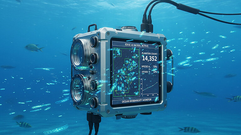
A CytoSub will generate up to 1,500 in situ images per minute, which can also capture small phytoplankton species, cell abundance with an in situ flow cytometer and will be compared to the cost-effective alternative of the PlanktoScopes.
The CAU will develop an energy-efficient neural network for image analysis (AI product 2) using CytoSub and AMB data. AI-Product 2 will be suitable for deployment on small computers, such as Raspberry Pis, as well as on smartphones, tablets, and laptops directly on site. It will enable in situ data analysis with battery-operated equipment in the field.

Sensors for depth profiles
• CTD (with oxygen)
• CO2, CH4
• Nitrate
• Biomass
• Parallel deployment with in situ imaging instruments (CytoSub, cf. AI Product 2)

Sensors for Surface Measurements
• CTD (with oxygen)
• CO2, CH4
• Nitrate
• Biomass
• Phytoplankton primary production
• Parallel use with in situ imaging techniques (PlanktoScope, see AI Product 2)
• Synchronized deployment with AI-Product 3 (including quality control, CO2 uptake assessment)
Quality Control in KIMMCO
• Oxygen with Winkler
• CO2 with DIC/Alkalinity
• CH4 with Gas Chromatography
• Chl a with HPLC
• CDOM with Spectrometry
• Nitrate with QuAAtro AutoAnalyzer
• Primary production with 14C
AI Product 2: FAIR Phytoplankton Image Recognition Tool
Camera-Based Methods

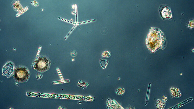
Plankton photographed below a microscope. These images can be used to train the phytoplankton image recognition tool. Photo: Sarah Uphoff, GEOMAR.

The PlanktoScope is offered as low-cost open-source kit. The device can use a flow-through method to take pictures of plankton in small water samples and classify them. Photo: Guillaume Leguen/ Coralie Lebouvier - Le Temps Des Sciences

The Cytosub can be lowered up to 200 meters into the ocean and take pictures of plankton directly. Additionally, species and frequencies of phytoplankton can be automatically determined. Photo: Gülce Kurtay, GEOMAR
Why is a phytoplankton image recognition tool necessary? The traditional method of identifying phytoplankton through microscopy is time-consuming and requires extensive taxonomic knowledge. Therefore, an automatic AI analysis of images could provide stable results over long periods and in different laboratories while saving time. For underwater imaging to function, it is crucial that the AI has low power consumption.
The FAIR image recognition tool is based on previous work in zooplankton analysis and follows deep learning approaches that can benefit from existing databases, such as Ecotaxa. The algorithms will be FAIR, meaning they will be freely available. Due to the lack of research on high-resolution phytoplankton images, we will investigate which organism characteristics are most relevant for automated classification.
AI Product 3: Improved Satellite Algorithms
Satellite-based Monitoring

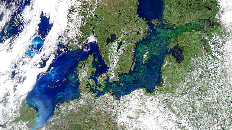
In this project, satellite data of phytoplankton occurrences are linked to in situ measurements to improve the calibration of satellite data in shallow coastal waters of the Baltic Sea. Photo: NASA/PACE

To improve the assessment of satellite data in shallow coastal waters, in situ measurements are conducted using an above/below-water spectral radiometer (Ramses). Photo: Eike Schütt, CAU
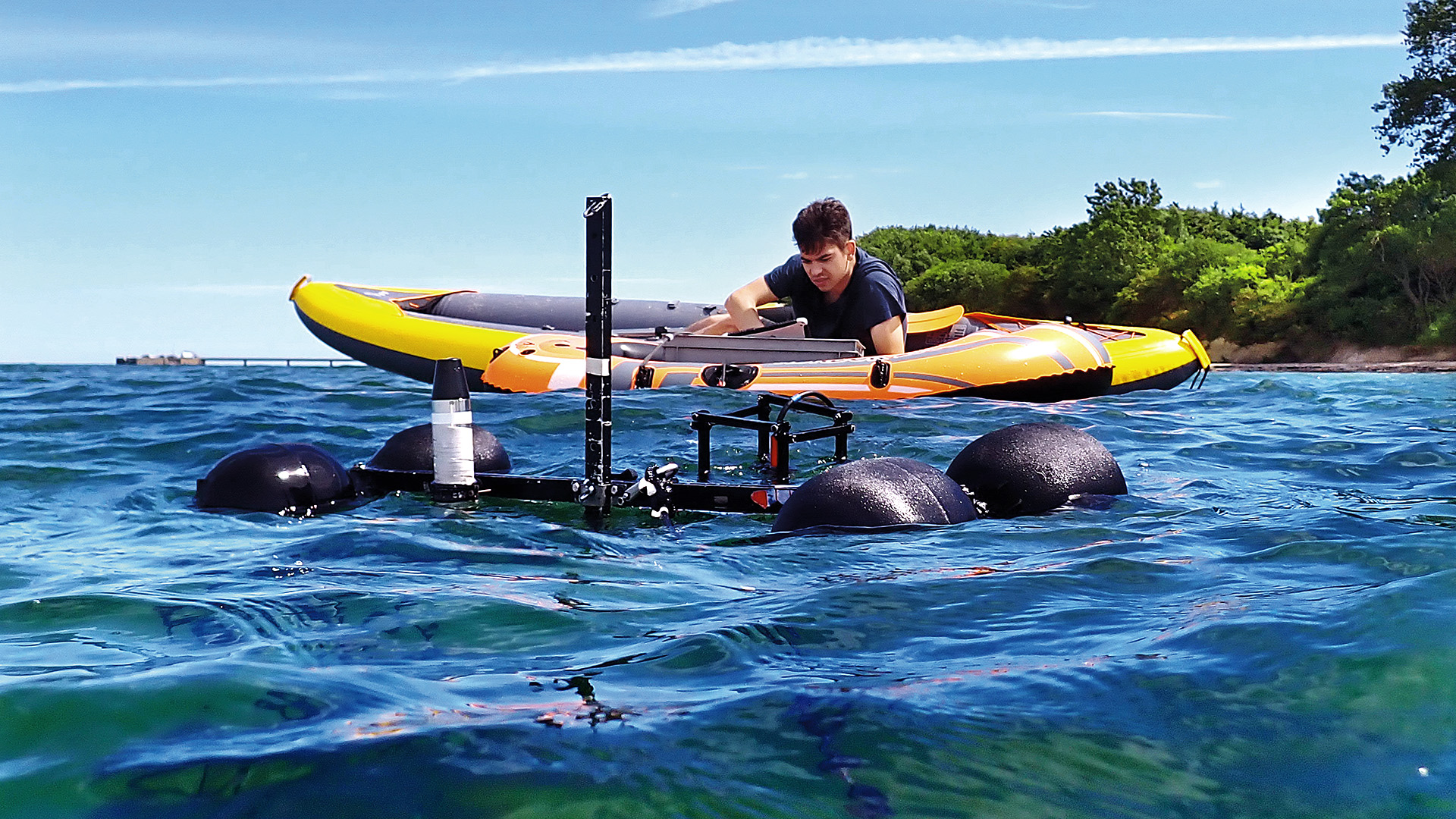
The data from the Ramses above/below-water spectral radiometer is collected in real-time from the boat. Photo: Eike Schütt, CAU
Current Situation: Measurements of phytoplankton are usually taken point-in-time and with low temporal resolution, leading to uncertainties in estimating phytoplankton biodiversity and its CO2 uptake potential.
- NEW in KIMMCO: AI-driven and satellite-based monitoring can enable continuous spatial and temporal monitoring of phytoplankton groups.
- Limitations are: the footprint of satellite measurements is over 300 meters and the depth integral in the water column only goes up to the Secchi depth. The Secchi depth is approximately the lower limit of the euphotic zone, where enough light is present for phytoplankton growth.
- Possible improvements by AI: calibration could lead to improved vertical distribution and spatial resolution.
The project will link satellite data to in situ phytoplankton presence data to improve the calibration of satellite data in the shallow coastal waters of the Baltic Sea. This will allow for the high-resolution, large-scale determination of microalgae and their productivity. Synchronizing shipborne measurements with the overflight times of the correct satellites is necessary for this process. An AI-driven climate visualization tool will clearly illustrate the status of the near-coastal Baltic Sea ecosystem.
To improve the evaluation of satellite data in shallow coastal waters, in situ measurements will be carried out using an above/below-water spectral radiometer (Ramses). Ramses measures incoming radiation from the sun just above and just below the water surface and upwelling radiance, i.e. light coming from the water column below the sensor toward the water surface. These additional light data will allow algorithms to be adapted specifically to the conditions in the Baltic Sea. These data will also be used for CO₂ fixation calculations in AI Product 4.
AI-Product 4: Climate Protection Visualization Tool
New AI Applications for connecting, analyzing, quantifying indicators, and visualizing the climate protection

The visualization tool is intended to present the complexity of the project with the numerous different data-generating devices.
- The monitoring authorities will have access to project data and methods through this tool. This will enhance the transferability of the AI products developed in stages 1-3.
- The public can be informed of and participate in the results through this tool.
- For visualization, proven methods such as, for example, the BELUGA Navigator, ArcGIS StoryMaps, or Digital Earth Viewer are used, which are linked to FAIR repositories to create components for an operational "digital twin".
-
Project lead: Prof. Dr. Anja Engel
GEOMAR Helmholtz Centre
for Ocean Research Kiel
Wischhofstraße 1 - 3, D-24148 Kiel
Phone: +49 431 600-1510
Mail: aengel(at)geomar.deProject coordination: Dr. Frauke Pescheck
GEOMAR Helmholtz Centre
for Ocean Research Kiel
Wischhofstraße 1 - 3, D-24148 Kiel
Phone: +49 431 600-1510
Mail: kimmco(at)geomar.de
-
-
► Aquaspect-Project: Automated identification of zooplankton using AI
► Recover-Projekt: Interreg Project for finding and evaluating restoration measures for the Baltic Sea in the German-Danish area
► Time Series Station Boknis Eck: Storymap