Clouds: One of the Great Mysteries of Climate Science
GEOMAR contributes to the international EUREC4A campaign in the subtropical North Atlantic
Clouds are an essential climate factor. Climate models show that shallow clouds in the trade wind regions react particularly strongly to global warming and thus influence future climate changes. In order to investigate the reaction of clouds and atmospheric convection to temperature changes, researchers need observational data on the dynamics of the atmospheric and oceanic conditions in which clouds form and dissolve. To this end, the field study EUREC4A will study the life cycle of clouds in the trade wind region in great detail and thus obtain a complete picture of atmospheric and oceanic processes.
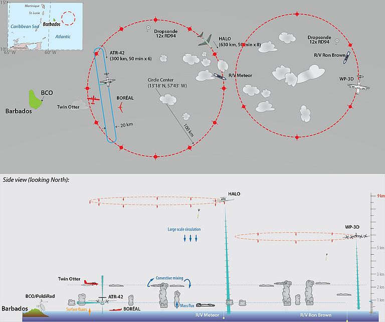
The measurement campaign will take place in the subtropical Atlantic east and south of the Caribbean island of Barbados. Five research aircraft and four research vessels will be deployed which will be combined with a ground station, the Barbados Cloud Observatory, a large number of autonomous measuring robots in air and water and satellite remote sensing methods. The overall coordination of EUREC4A, in which more than 40 partner institutions participate, is carried out by Prof. Bjorn Stevens (Max Planck Institute for Meteorology, MPI-M, Hamburg, Germany), and Dr. Sandrine Bony (Laboratoire de Météorologie Dynamique, Paris, France). Their initiative builds on, and extends, on a decade of collaboration with Barbadian scientists at the Caribbean Institute for Meteorology and Hydrology (CIMH), under the leadership of its Principal, Dr. David Farrell.
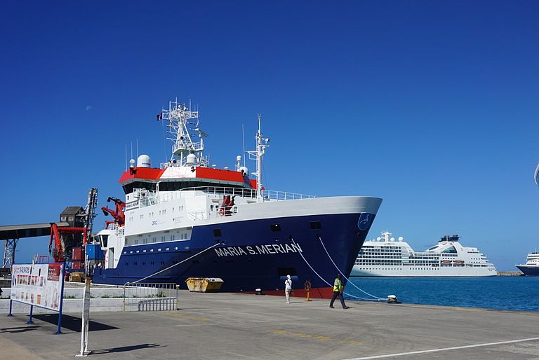
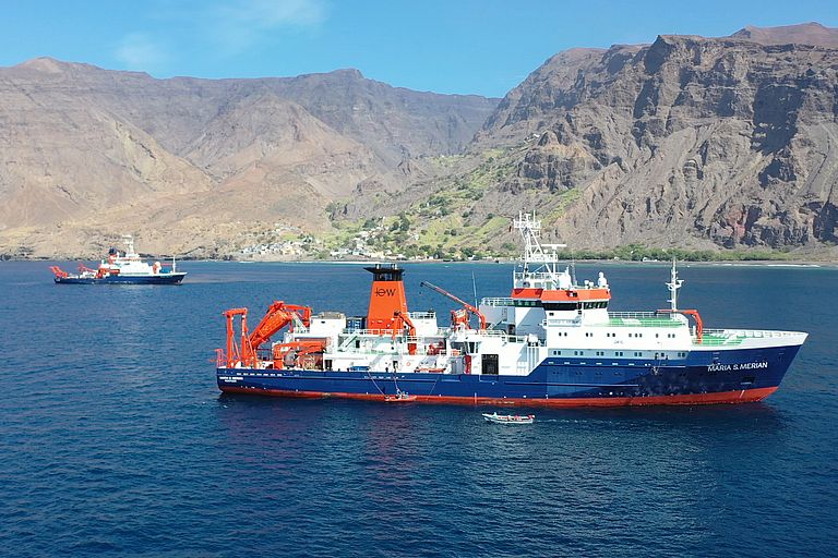
The GEOMAR Helmholtz Centre for Ocean Research Kiel is actively involved in the campaign by leading the ship expedition MSM89 with the German research vessel MARIA S. MERIAN. The research vessels are used to carry out measurements simultaneously in the atmosphere and the ocean. With radar, lidar (laser radar) devices and radiosondes the atmosphere is continuously observed "from below". Cloud heights and cloud composition, winds and aerosols are registered. A specially developed balloon kite ("Max Planck CloudKite"), that is pulled behind the MERIAN, swaps into the clouds and records the extremely small-scale movement of individual drops forming a cloud using holography techniques.
Sampling devices will be deployed from the ships to measure temperature, salinity and currents. But also the activity of microorganisms, plant growth and the ocean's uptake of carbon dioxide will be recorded. "The spatial variability at the sea surface is an important boundary condition for the development of the overlying atmosphere and thus also for cloud formation", says Johannes Karstensen, GEOMAR, chief scientist on board the MARIA S. MERIAN, "Especially in large eddies and frontal zones we want to understand the coupling of oceanic and atmospheric processes and thus make them easier to represent for model simulation". The campaign on the MARIA S. MERIAN benefits in particular from the Helmholtz Centres' interdisciplinary activity in the Helmholtz MOSES programme, which focuses on the observation of extremes in oceanic eddies. In a blog (www.oceanblogs.org/msm89) the researchers on board the MSM will report on their work during the campaign.
On the German side, four Max Planck Institutes (MPI-M, MPI for Dynamics and Self-Organisation, MPI for Chemistry and MPI for Marine Microbiology), five universities (Hamburg, Hohenheim, Cologne, Leipzig and Munich), three Helmholtz institutions (German Aerospace Center DLR, GEOMAR and Helmholtz Centre Geesthacht Centre for Materials and Coastal Research), the Leibniz Institute TROPOS and the German Weather Service DWD are involved in the EUREC4A campaign.
The EUREC4A campaign is funded and supported by the European Research Council (ERC), the Max Planck Society (MPG), the Centre National de Recherche Scientific (CNRS), the German Research Foundation (DFG), the Caribbean Institute for Meteorology and Hydrology (CIMH), the Natural Environment Research Council (NERC)
High-res images:
Graphic showing the planned EUREC4A campaign .Source MPI-M
Contact:
Dr. Andreas Villwock (GEOMAR, Communication and Media), +49 431 600-2802, presse(at)geomar.de
Dr. Annette Kirk (Max-Planck-Institut für Meteorologie, Communication), +49 40 41173 374, annette.kirk(at)mpimet.mpg.de


