
Dr. Jörg Bialas
Phone: 0431 600-2329
e-mail:
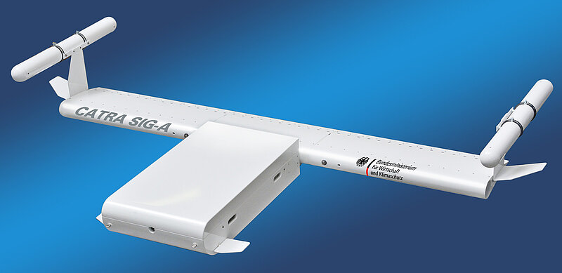
CATRA
CATRA
CATRA - Route-following seismoacoustic submarine cable detection
Cooperation project: emma Technologies GmbH (coordinator) and TEEC GmbH
Subproject GDY: CATRA sensor- and navigationdevelopment
Funded by: BMWi
Duration: 01.12.20 - 30.11.2023
Web page: follows
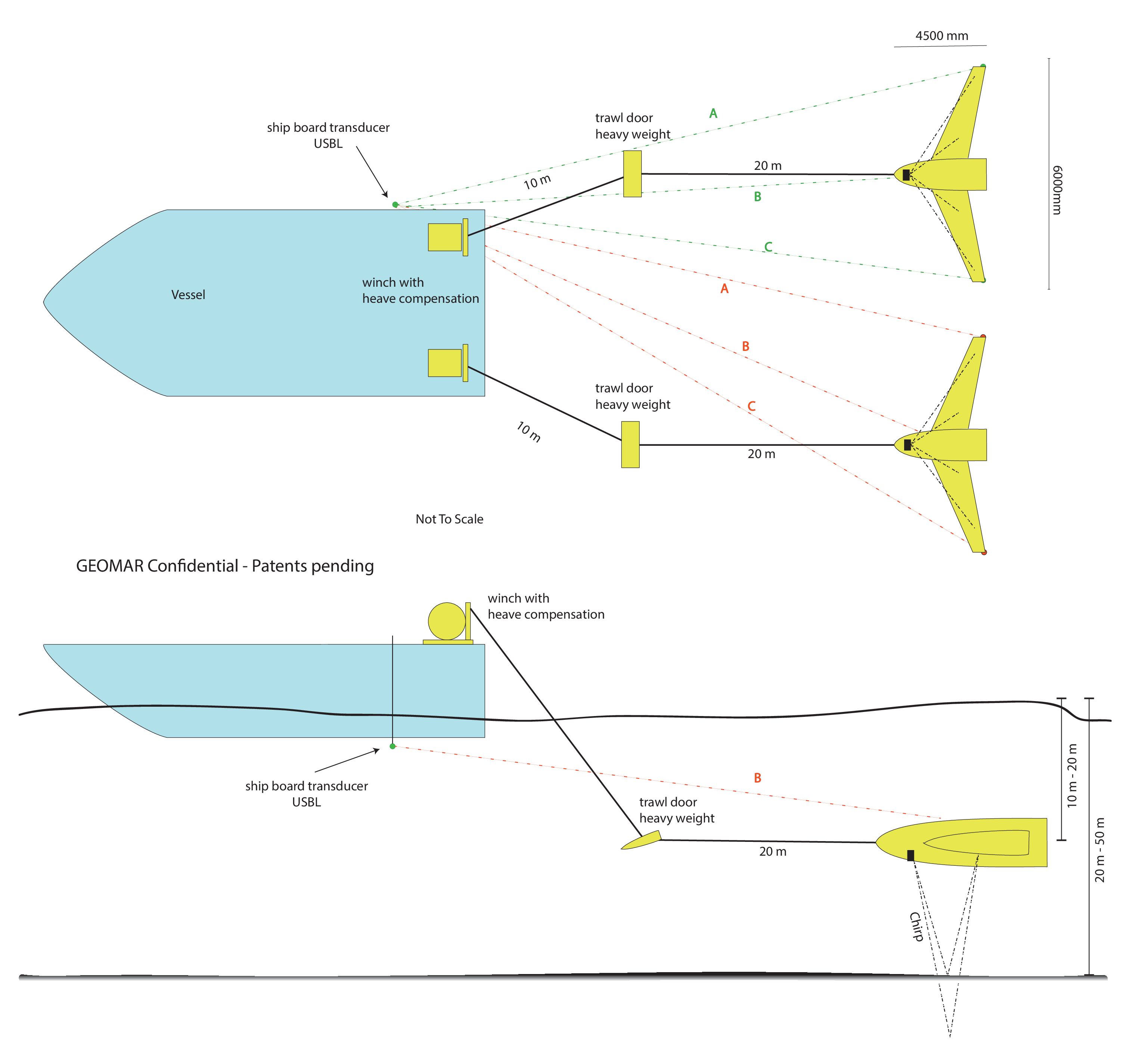
European energy supply and communication links are ensured by a large number of submarine cables in the North and Baltic Seas. With the expansion of new wind farms in the context of renewable energies, further cable routes will become necessary. The two German operators TENNET and 50hertz alone have around 15 submarine cables under construction or in planning. The installed submarine cables are buried in the seabed at a depth of usually 1.5 m to 5.0 m to protect against damage (e.g. fishing, emergency anchors) and to ensure the ease and safety of shipping traffic. After installation and in the course of maintenance and inspection, it must be ensured that the cables run at a sufficient depth in the seabed and are covered with sediment in accordance with the permit. Control of these conditions for approval and compliance during operation must be demonstrated to the approval authority, the Federal Maritime and Hydrographic Agency (BSH), by repeated surveys. It is important for the operator to ensure that the cables do not sink deeper into the sediment, as the lack of cooling reduces the performance of the cable. Surprisingly, no measurement system has yet been developed to economically control energy submarine cables during operation. The difficulty of surveying is to clearly map a cable with a small diameter of only about 7.5 cm to 25 cm at a depth of a few meters below the seabed.
The objective of this project is to develop a ready-to-use demonstrator or prototype of a ready-to-use survey system that will provide an economical, reliable, and a permitting authority acceptable survey of submarine cables. This should involve surveying with only one profile run along the cable route, while the lateral survey range of the system must capture unknown deviations of the cable from the planned cable route of several meters. Mapping systems tied at the sea surface are highly weather dependent due to sea state effects on the equipment carrier. To extend the weather window, a submerged equipment carrier decoupled from the sea state will be developed.
Such a system would also open up new possibilities for other applications that search for small objects at shallow burial depths. Preliminary exploration of cable or pipeline routes for possible disturbing bodies, such as boulders that interfere with the advance of excavation machines, would be possible particularly economically in a profiling measurement procedure without costly area exploration. Furthermore, archaeometry would also be worth mentioning, which searches for and would like to map sunken remains of building structures. It would also be conceivable to explore old munitions dumping areas, as far as explosive carriers such as torpedoes, mines or the like have silted up and are no longer detected by pure surface methods (e.g. multibeam).
Three patent applications have already been filed by the applicants with the German Patent and Trademark Office (DPM) for the system development proposed in this project.