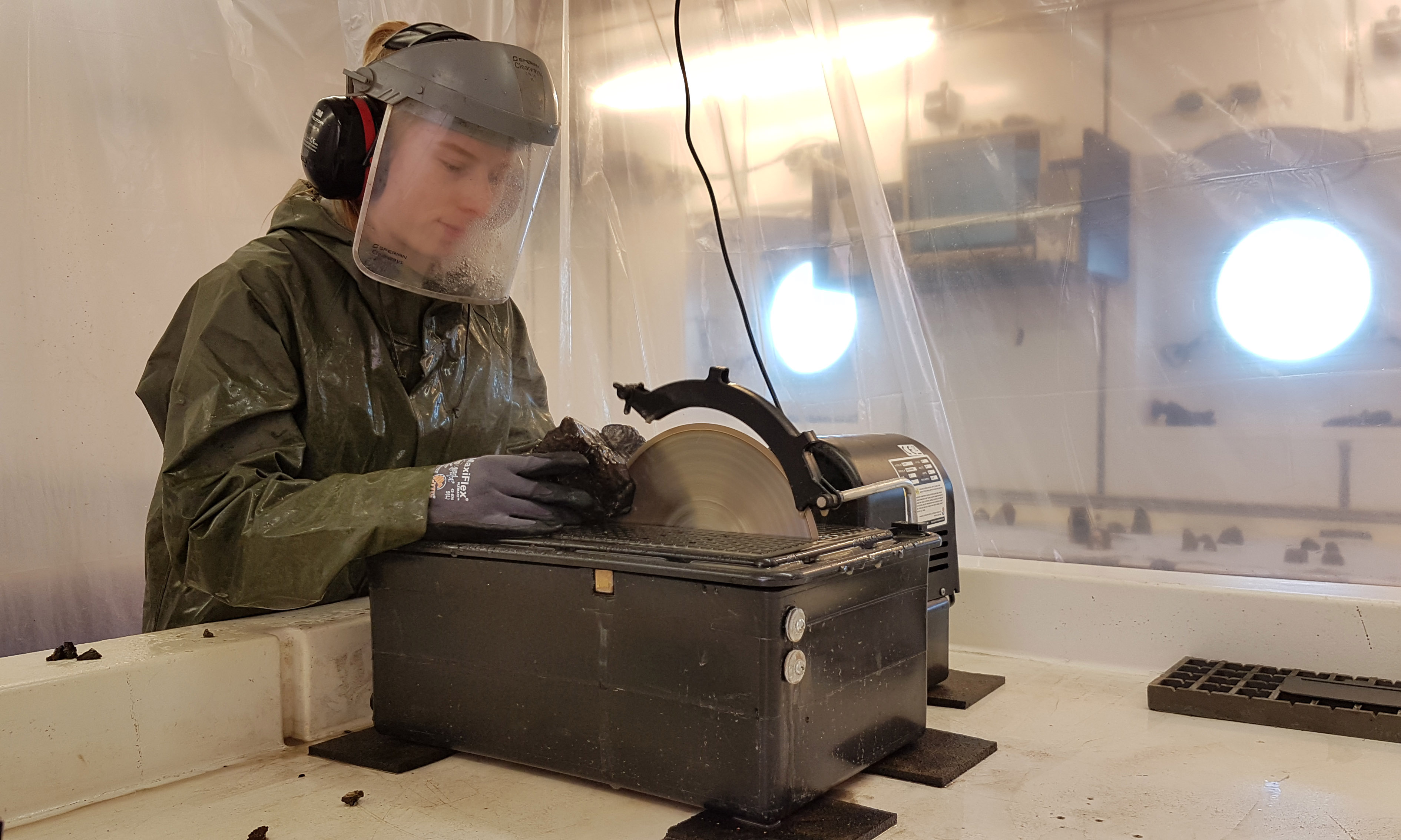
Volcanic rock acts as an archive of Earth's history. Here, a scientist on board the METEOR cuts through a rock sample recovered from King's Trough.
Photo: Fabian Hampel, GEOMAR
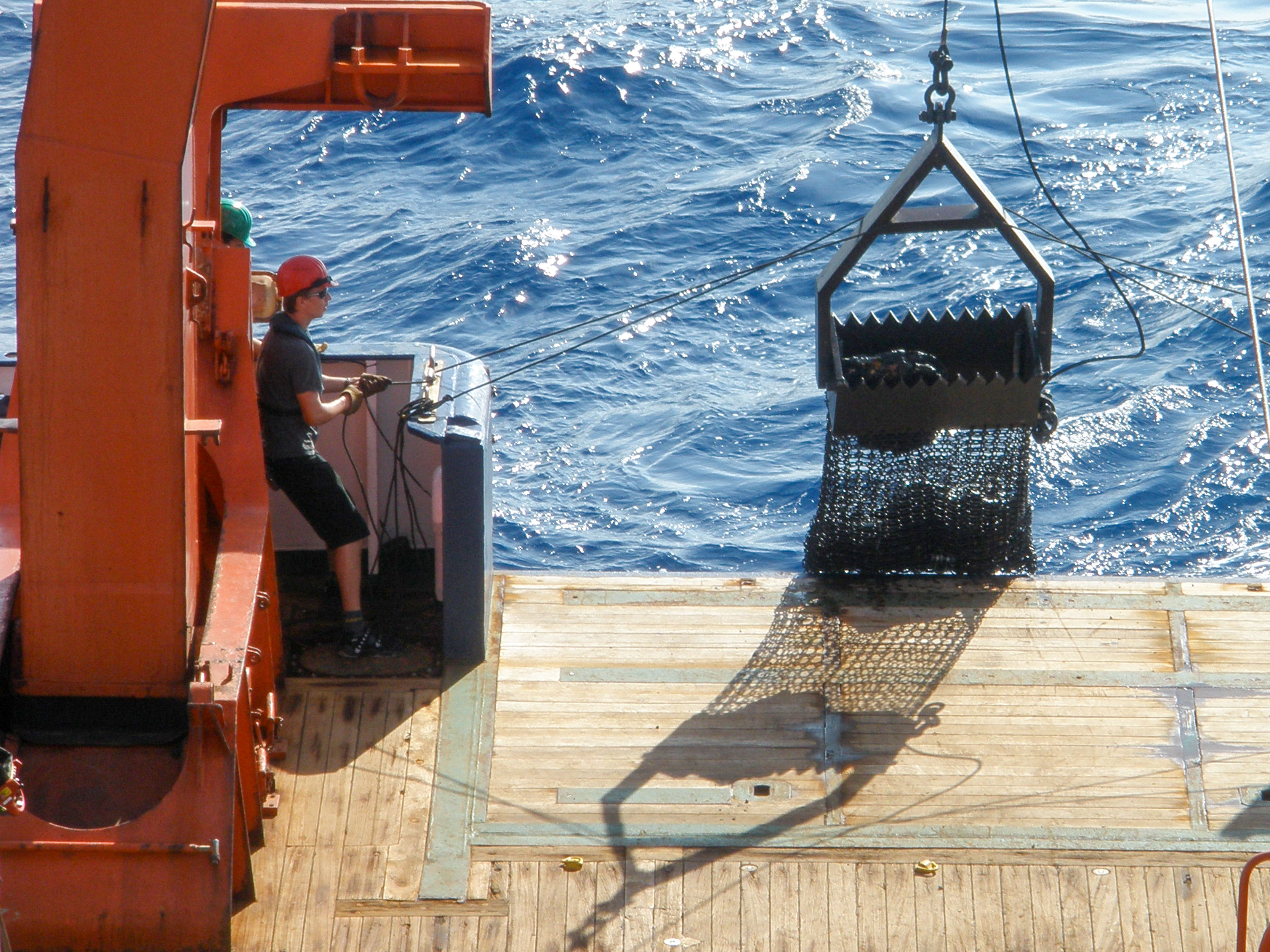
The chain bag dredge is brought back on board. It can be used to collect specific rock samples from depths of several thousand metres.
Photo: IfM-GEOMAR

Bathymetric map of the King’s Trough complex with associated deep basins at its eastern end (Peake and Freen Deeps) based on new bathymetric data combined from GEOMAR cruise M168 and Portuguese cruise EMEPC/PEPC/LUSO/2013 (viewing direction oblique from the south, with 4x vertical exaggeration).
Inset shows overview of the eastern North Atlantic based on www.gebco.net.
The “Grand Canyon” of the Atlantic
How a shifting plate boundary and hot mantle material formed one of the largest canyons in the ocean
Deep canyons on land, such as the Grand Canyon, are typically carved by the erosive power of flowing water. No comparable process occurs in the ocean. Yet there are structures underwater that exceed even the largest terrestrial canyons in size. One such colossal submarine canyon lies roughly 1,000 kilometres off the coast of Portugal: The King’s Trough Complex. It comprises a system of parallel trenches and deep basins extending some 500 kilometres. At its eastern end, Peake Deep represents one of the deepest points in the Atlantic Ocean.
What caused this extraordinary feature to form? An international team led by the GEOMAR Helmholtz Centre for Ocean Research Kiel now presents new insights in Geochemistry, Geophysics, Geosystems (G-Cubed), published by the American Geophysical Union (AGU).
“Researchers have long suspected that tectonic processes – that is, movements of the Earth’s crust – played a central role in the formation of the King’s Trough,” says lead author Dr Antje Dürkefälden, marine geologist at GEOMAR. “Our results now explain for the first time why this remarkable structure developed precisely at this location.”
Seafloor opened like a zipper
The study suggests that between approximately 37 and 24 million years ago, a plate boundary between Europe and Africa temporarily ran through this part of the North Atlantic. Along this boundary, the crust was stretched and fractured – similar to a zipper opening from east to west.
What is particularly notable is that even before the plate boundary shifted here, the oceanic crust in this region was unusually thick and thermally altered. This was caused by upwelling hot material from the Earth’s mantle – a so-called mantle plume, a long-lasting stream of molten rock rising from deep within the Earth. The researchers interpret this as an early branch of the present-day Azores mantle plume.
“This thickened, heated crust may have made the region mechanically weaker, so that the plate boundary preferentially shifted here,” explains co-author PD Dr Jörg Geldmacher, marine geologist at GEOMAR. “When the plate boundary later moved further south towards the modern Azores, the formation of the King’s Trough also came to a halt.”
The King’s Trough therefore provides a vivid example of how processes deep in the mantle and movements of the overlying tectonic plates are linked, and how earlier mantle activity can influence the location of subsequent tectonic deformation.
The results not only improve our understanding of the geodynamic evolution of the Atlantic Ocean, but also offer insights into how similar processes are occurring today. In the Azores region, a comparable trench system – the so-called Terceira Rift – is currently forming, again in an area of unusually thickened oceanic crust.
Expedition, rock samples and age dating
The findings are based on data from research expedition M168 with the research vessel METEOR in 2020, led by Antje Dürkefälden. Using a high-resolution sonar system, the team first created a detailed map of the area, then selectively recovered volcanic rocks from different parts of the trench system using a chain bag dredge.
In the laboratory, the researchers analysed the chemical composition of the samples. The age of selected rocks was determined at the University of Madison (Wisconsin, USA). Additional bathymetric data were provided by the Portuguese research centre Estrutura de Missão para a Extensão da Plataforma Continental (EMEPC). Researchers from Kiel University and Martin Luther University Halle-Wittenberg were also involved in the study.
Original publication:
Dürkefälden, A., Geldmacher, J., Hauff, F., Stipp, M., Garbe-Schönberg, D., Frick, D. A., Jicha, B., Ribeiro, L. Pinto, Gutjahr, M., Schenk, J. & Hoernle, K. (2025): Origin of the King’s Trough Complex (North Atlantic): Interplay Between a Transient Plate Boundary and the Early Azores Mantle Plume. Geochemistry, Geophysics, Geosystems 26(12), Art. e2025GC012616.
https://doi.org/10.1029/2025GC012616
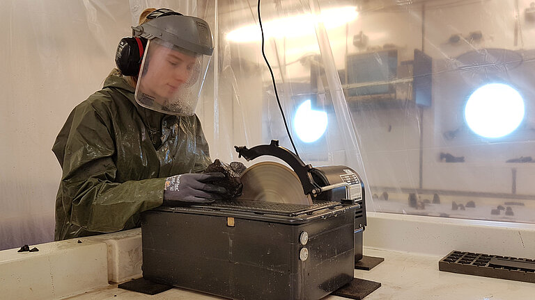
Volcanic rock acts as an archive of Earth's history. Here, a scientist on board the METEOR cuts through a rock sample recovered from King's Trough.
Photo: Fabian Hampel, GEOMAR
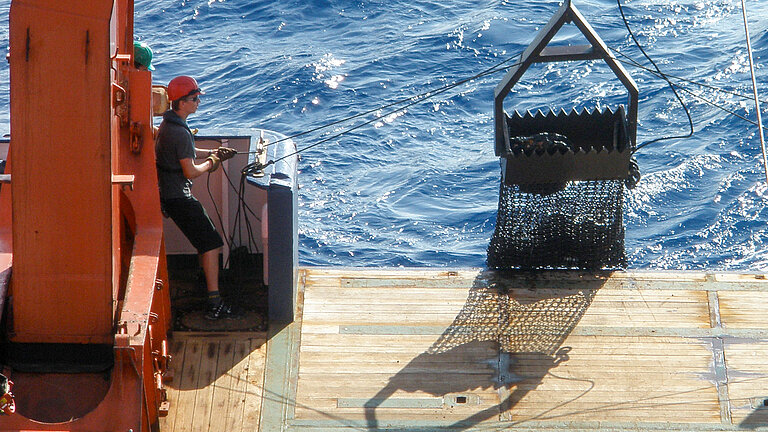
The chain bag dredge is brought back on board. It can be used to collect specific rock samples from depths of several thousand metres.
Photo: IfM-GEOMAR

Bathymetric map of the King’s Trough complex with associated deep basins at its eastern end (Peake and Freen Deeps) based on new bathymetric data combined from GEOMAR cruise M168 and Portuguese cruise EMEPC/PEPC/LUSO/2013 (viewing direction oblique from the south, with 4x vertical exaggeration).
Inset shows overview of the eastern North Atlantic based on www.gebco.net.