Image of the month: February 2019
The Grimaldi Seamounts in the Eastern Tropical North Atlantic
About 800 kilometres west of the West African state of Guinea the Bathymetrist Seamounts are located at a depth of 4,000 metres. This chain of underwater volcanoes came into existence less than 60 million years ago.
The Bathymetrist Seamounts are so-called intra-plate volcanoes. This means they did not form at the border of two tectonic plates, but in the middle of such a plate. The Canary Islands, Cape Verde or Hawaii belong to the same category. However, many questions about the age and origin of the Bathymetrist Seamounts are still open. It is, for example, unknown whether these Seamounts were built up by a HotSpot, belong to a nearby flood basalt province or if fractures and faults in the oceanic crust caused their development.
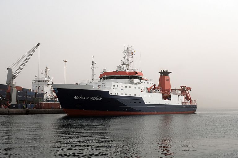
One reason for the open questions is that, until the end of 2017 only low resolution maps and just a few rock samples from the ocean floor in this region were available. A five-week expedition of the German research vessel MARIA S. MERIAN led by Kiel geologist Froukje van der Zwan at the end of 2017/beginning of 2018 has drastically changed this situation.
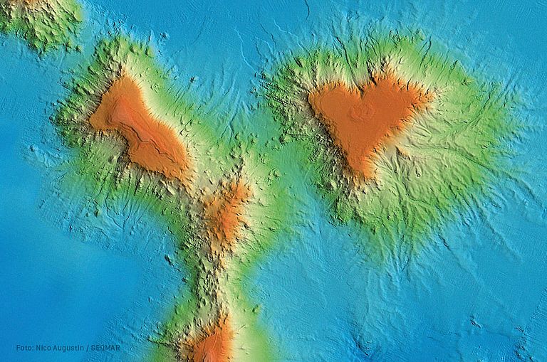
With MERIAN's multibeam echosounder system, the team was able to measure a total of 67,600 square kilometres of seafloor. The expedition not only produced the first high-resolution maps of already known structures. The geologists and bathymetric experts on board also found numerous, so far completely unknown structures and seamounts in their survey data.
The image of the month shows a group of seamounts known in the literature as Grimaldi Seamounts – after the ruling family of the Principality of Monaco (left: Princesse Alice Seamount; right: Hirondelle Seamount). These volcanoes were mapped for the first time during the expedition with high resolution and rise more than 3000 meter from the 4000 meters deep ocean floor.
The geochemical and petrological analyses of the samples obtained during the expedition are still ongoing, but the seafloor maps alone have significantly expanded our knowledge of the structure of the earth's crust and the volcanism off the coast of West Africa.
Currently, the research vessel METEOR (Expedition M152/2) is working around the Bathymetrists Seamounts. In a supplementary study lead by the University of Hamburg and with the participation of GEOMAR, researchers want to use seismic methods to learn more about the volcanoes and the surrounding oceanic crust.
Links:
www.oceanblogs.org/msm70 Expedition blog to read up on
www.geomar.de/e345776 Further information about the expedition MSM70
www.ldf.uni-hamburg.de/meteor/wochenberichte.htmlInformation about the current expedition of the research vessel METEOR.


