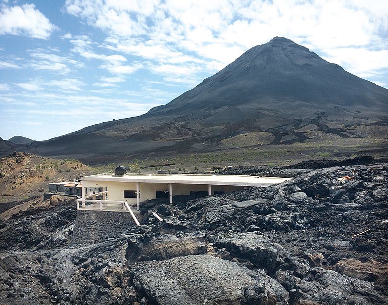
Pico do Fogo on Fogo island is a very active volcano. It last erupted from end 2014 to beginning of 2015. During the eruption, two villages got destroyed by the lava flows. Photo: Lisa Samrock, GEOMAR.
Bathymetric map of the submarine Cadamosto Seamount, which is located at a depth of 1,500 to 3,000 metres below sea level. Map: Tom Kwasnitschka, Lisa Samrock, GEOMAR
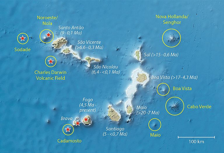
The map shows the islands of the Cape Verde archipelago with the known ages of the islands, which become younger from East to West, as well as the seamounts (yellow) and seismically and/or volcanically active regions (red stars) of the archipelago. The seafloor around the islands is 110-140 million years (Ma) old. Source: GEOMAR, Bathymetric Map: GEBCO.

Image of the month October 2018

Hotspot Volcanism above and under the Sea

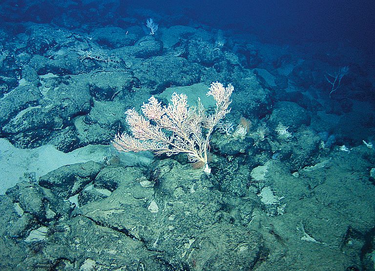
Cape Verde comprises islands of volcanic origin, and volcanic seamounts in the submarine part of the archipelago. The volcanism is caused by a so called hot spot: hot ductile rock rises within the deep Earth and forms hot magma, which ascends through the Earth’s surface. As a result, also the regional seafloor arches upward. Characteristic for Cape Verde are different chemical compositions of rocks, and explosive volcanic eruptions as well as viscous lava flows. The archipelago began to form in the eastern part about 20 million years ago. An age progression towards the west can be observed. At present, the oldest islands (Sal, Boa Vista, Maio) are flat and eroded, whereas the younger western islands have a prominent topography. Fogo is an active volcano, which erupts every 20 years on average and therefore ranks amongst the most active volcanoes in the Atlantic. The westernmost islands and seamounts (Santo Antão, São Vicente, Brava, as well as Nola, Sodade and Cadamosto seamounts) are seismically active, which indicates magmatic activity underground. Aim of recent studies in Cape Verde is to understand how the archipelago formed and evolved with time, for example where the next island could form, and which natural hazards the local population faces.
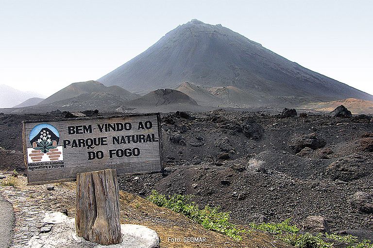
The Pico volcano on the island Fogo testifying the volcanic origins of Cape Verde. Photo: GEOMAR.
Pico do Fogo on Fogo island is a very active volcano. It last erupted from end 2014 to beginning of 2015. During the eruption, two villages got destroyed by the lava flows. Photo: Lisa Samrock, GEOMAR.
Bathymetric map of the submarine Cadamosto Seamount, which is located at a depth of 1,500 to 3,000 metres below sea level.  Map: Tom Kwasnitschka, Lisa Samrock, GEOMAR
Bathymetric map of the submarine Cadamosto Seamount, which is located at a depth of 1,500 to 3,000 metres below sea level. Map: Tom Kwasnitschka, Lisa Samrock, GEOMAR
The map shows the islands of the Cape Verde archipelago with the known ages of the islands, which become younger from East to West, as well as the seamounts (yellow) and seismically and/or volcanically active regions (red stars) of the archipelago. The seafloor around the islands is 110-140 million years (Ma) old. Source: GEOMAR, Bathymetric Map: GEBCO.