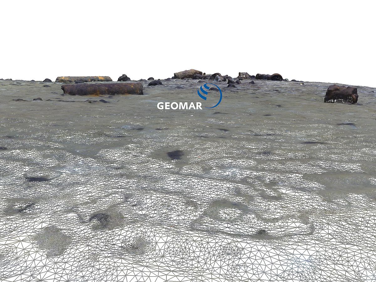
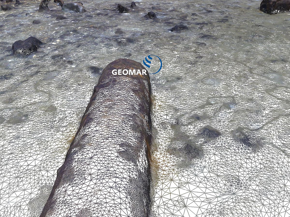
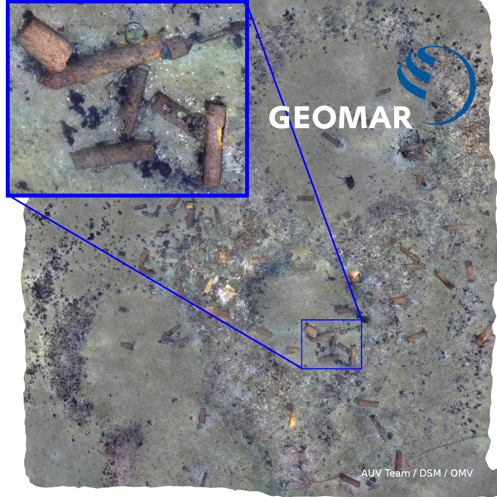
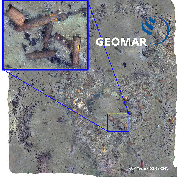
Even in the 21st century UXOs (unexploded ordnance) are found in Schleswig-Holstein and other parts of Germany and Europe, both on land and at sea. Additonally, after World War II, remaining munition and explosives have been disposed in the Baltic Sea and the North Sea (see also here). For more than seven decades housings and detonators have been affected by the salt water posing not only a threat to our environment and eco systems, but also to safety of bypassing ships and hindering the extension of offshore wind energy that require safe cable connections to shore. In several projects, GEOMAR contributes to investigating and dealing with these threats, e.g. in Probannt. To allow for monitoring the state (corrosion, deformation, cracking,...) or motion (by currents, silting, undercutting), detailed and faithful mapping is required. Optical approaches, in particular from Autonomous Underwater Vehicles (AUV) provide millimeter resolution and also allow obtaining detailed 3D models from overlapping imagery. The sample data of this page shows tens of thousands of square meters of reconstructed seafloor (German Waters), for which we have obtained a digital representation that can be analysed with all water effects removed. Each of the AUV photos (more information about our robots) shows just a few square meters, as they are photographed in murky water from very low altitudes. Only combining thousands of photos into one map allows to monitor the distribution and state of the munition at the seafloor.