DSM Software & Download

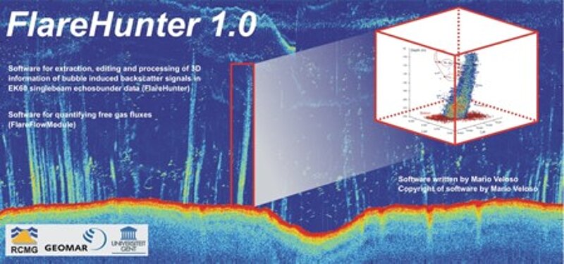
FlareHunter and FluxModule
Detecting free gas release at the seafloor and quantifying gas fluxes is one of the main work topics of the DeepSea Monitoring Group. In cooperation with Ghent University we developed (and are still advancing) our MATLAB-based FlareHunter software to motion-compensate and edit EK60 single beam echosounder data and quantify gas fluxes. read more
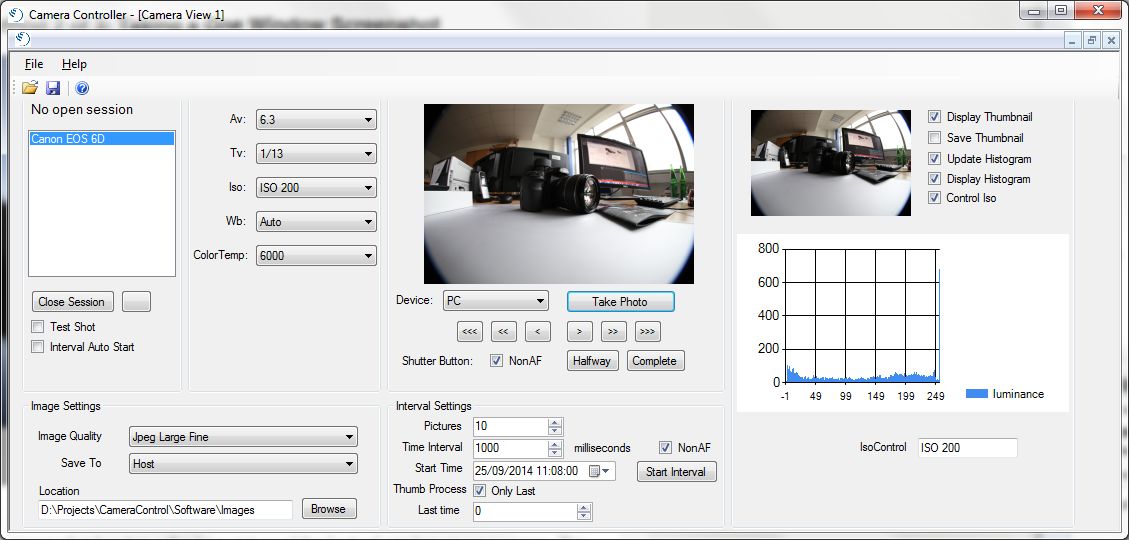
CameraController software
The CameraController software was developed to operate Canon cameras for long-term observations in underwater scenarios. The user of the software is able to set every available camera setting (e.g. aperture value, exposure time value, Iso, etc.) of the connected camera and shoot images remotely. read more
GMT-Script Tool
The GMT-Script Tool helps to write GMT scripts. In the end, it is a text editor that has many useful functionalities and predefined command lines for processing and visualizing bathymetric data. read more
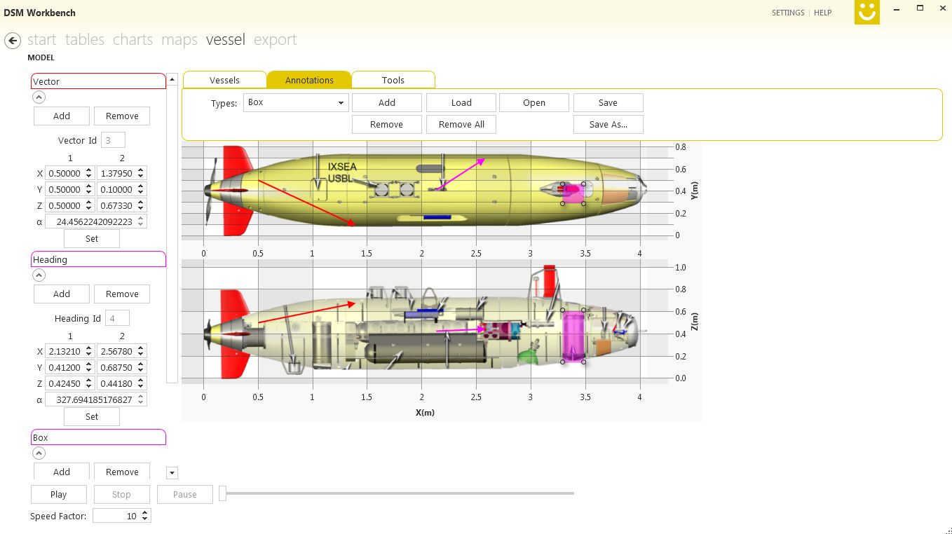
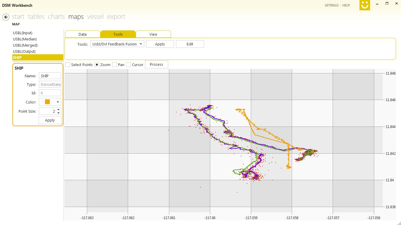
GEOMAR Workbench
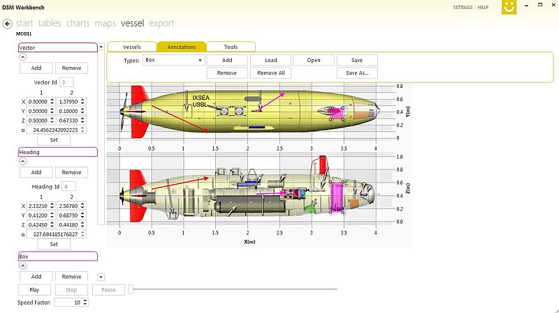
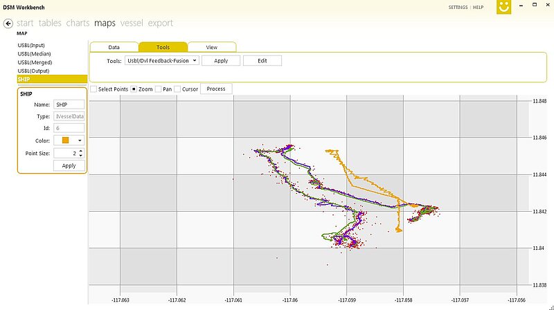
The DSM Workbench is a stand-alone, freely available tool for processing data from various instruments commonly used in marine research (CTD, AUV, turbidity, USBL, DVL, etc.). The Workbench allows users to view, filter, edit and merge such data sets. Different data sources are synchronized and displayed in charts and on a map. Several general processing tools (e.g. averaging or median filtering) can be applied to each data series. Other tools combine the information from different data sources. For instance, the "DVL and USBL Sensor Fusion Tool" uses USBL navigation data and DVL data to derive the "best final" navigation route of an ROV/AUV. At the end, individual output files can be compiled from selected properties of each input and processed data set.
The software requires Windows 7 or higher. You can install the software from this location: Click here.
Some test data can be found here: Click here.
DSM Sonar Software
Post-processing of sonar data is a common task in ocean science. This includes the creation of bathymetric maps, the use of seafloor back scatter information to determine sediment types as well as the analysis of water column data, e.g. for the assessment of fish populations or the quantification of gas releases from the ocean floor (methane seeps). Many commercial and free post processing tools for these tasks exist, but since there is a wide range of sonar manufactures with individual data formats not every format is supported by these applications. The DSM Sonar Software is a collection of software libraries and applications to facilitate access to sonar data of various formats and convert between different formats. The conversion of an unsupported format into a supported one makes it possible to process sonar data with existing post processing tools. The target users for these converters are scientists and hydrographers. The involved format and sonar tool libraries are valuable for software developers in the field of automated sonar data analysis. The modular approach and structure enable that developers pick only necessary components to include them in their own software projects.
The Software can be found here: Git Repository
DataViewer (Digital Earth)
A comprehensive study of Earth’s environment requires understanding of data acquired with a myriad different sensors or produced by various models. Depending on its nature, tools that aid with the visualisation of said data may not be readily available for a desired platform or may come in the form of outdated software of low quality that complicates proper interpretation. Even assuming all corresponding visualisation tools as given, the fragmented representation in multiple application windows deters a holistic approach. The 4D Data Viewer is a component-wise scalable web-based framework for simultaneous visualisation of multiple data sources that helps contextualise mixed observation and simulation data in time and space.
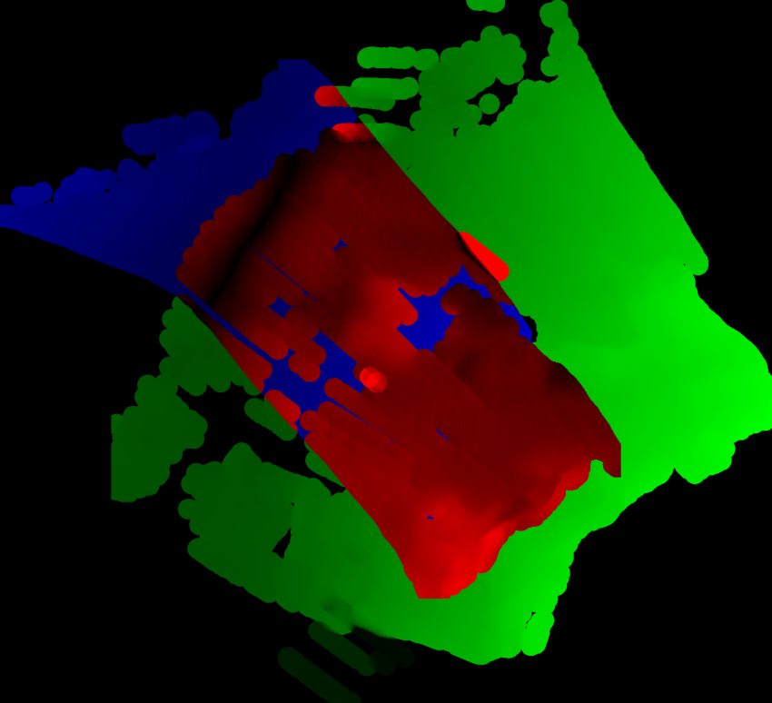
MBTilematching
A tool that allows to automatically detect drift in AUV navigation by adjusting the ovelapping bathymetry. A corrected navigation is created that can be merged with the multibeam data to obtain better terrain maps.
The software is under development and can be accessed at https://git.geomar.de/compass/MBtilematching (an account for git.geomar.de is required to view the project).
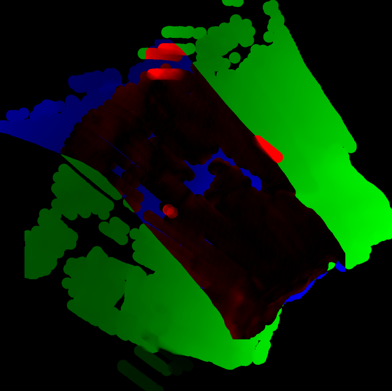
First image: Two tiles (green and blue) with overlap (black-red) using the original navigation. High differences in height are shown in red, low differences in black. Second image: Two tiles (green and blue) with overlap (black-red) using corrected navigation.
OceanCV
OceanCV focusses on computer vision algorithms for underwater image analysis. This includes image processing, pattern recognition, machine learning and geometric algorithms but also functionality for navigation.
The Software can be found here.
CoMoNoD
This is the demonstration code for the "Compact Morphology-based Nodule Delineation" algorithm. CoMoNoD is a rapid method to delineate poly-metallic (or manganese) nodules from vertical benthic images.
The software can be found here.