Working group DeepSea Monitoring
...a multidisciplinary group
Our group consists of natural scientists (from the fields of geology, geochemistry, geophysics, oceanography, environmental sciences), software engineers and data scientists (from computer science and statistics, people who use e.g. signal processing, photogrammetry or machine learning to extract knowledge from data) and technicians (in geochemical laboratory analysis, electronics and precision engineering) and thus covers a wide field with regard to technology development, generation and evaluation of data to answer our scientific questions.
Please also visit our site Staff and our Studentjobs & BA/MA-thesis topics in underwater computer vision and acoustics.
Our topics
The working group DeepSea Monitoring (DSM) addresses the following overarching issues:
in scientific research
- Detection, quantification and monitoring of gas flows (methane) from the sea floor into the water column and further into the atmosphere
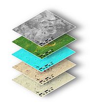
- Quantitative assessment of resources on the seabed, e.g. by means of detailed habitat mapping
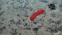
- Identification and annotation of organisms on the seabed
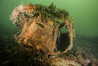
- Environmental monitoring before, during and after the delaboration of munitions in the sea

in application-oriented development research
- The (further) development of modular sensor systems and platforms, integration of robotic applications and artificial intelligence
- Development of optimal survey and sampling strategies
- Visual and computer-supported data exploration, in particular by artificial intelligence methods such as machine learning (by means of pattern recognition, data mining, visualisation and unsupervised learning processes)
- Development and experimentation with methods for refractive underwater camera calibration (see Oceanic Machine Vision Group)
Our methods
We use hydroacoustic (singlebeam and multibeam systems, sub-bottom profilers), electromagnetic (magnetometers) and optical (cameras, fluorometers, lasers) technologies in conjunction with post-processing and calibration techniques (filtering and statistical methods, photogrammetry, 4D reconstruction), and combine these methods with geochemical analyses of the sea surface, the water column (such as ICP-OES, GC-MS laboratory analyses) and the atmosphere (Picarro Analyzer).
At the same time, we are involved in the development of data science workflows for the storage and analysis (including visual exploration) of large amounts of multi-parameter data. Methods of pattern recognition and machine learning are applied to large image data sets, for example, with the help of a high-performance compute-cluster infrastructure.
We develop modular sensor systems like the BubbleBox, which uses automated video analysis to count and measure bubble sizes, and platforms like GasQuant-II which was designed to quantify gas flows. We use the GEOMAR large-scale equipment ROV and AUV for data generation and further develop adaptive and iterative navigation, e.g. for AUVs
We develop our own Software that you might want to explore.
Our publications
Our publication list can be found here.
DSM in the GEOMAR News
- Gesichtserkennung am Meeresboden (in German only)
- Digital Science (in German only)
- Understanding deep-sea images with artificial intelligence
- Fascinating photo mosaic from the seafloor in 4000 m depth
- GEOMAR-Informatiker erhält BRIESE-Preis für Meeresforschung (in German only)
- Detection of raw materials research by machine learning honoure
- World War II legacy has to be eliminated now!


