
T-SECTOR: Testing Solid Earth Climate connections Through mid Ocean Ridge time series
Geophysical surveys (PI: Heidrun Kopp)
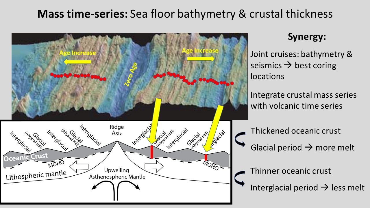
Ship-based multi-beam swath mapping and sediment profiling studies will be used to assess the morphology of the seafloor, specifically the distribution of abyssal hills and valleys, sediment thicknesses and disturbances affecting the sediments (for example, mass movements). Magnetics will be used to constrain the age of the crust. We will employ ocean bottom seismometers (OBSs) in a very dense station spacing of ~500m in order to identify the depth location of the seismic Moho, i.e. the boundary between the oceanic crust and the upper mantle, in order to retrieve crustal thickness variations between 500-800m over short distances of 2-3km. Acoustic signals will be reflected by the Moho as well as refracted through the upper mantle, and then will be recorded on the array of seismometers (60) deployed on the seafloor as the acoustic waves travel back up. We will use the travel time of the seismic signals to reconstruct the depth of the crust-mantle boundary and its variations along the profiles. The seismic results will be corroborated by potential field data using gravity as well as magnetic records. In addition, highresolution reflection seismic data using a 380m long streamer towed behind the vessel will resolve the sediment cover and basement variations. These data will be integrated with the bathymetric mapping to compare abyssal hill bathymetry with crustal thickness variations.
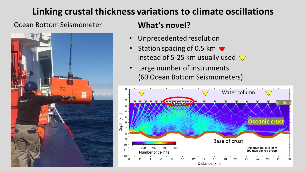
To link crustal thickness variations to climate oscillations we will place ocean bottom seismometers on the seafloor. These are autonomuos instruments used to determine the thickness of the crust at very high resolution, resolving short-scale variations in crustal thickness that will be matched to the coring information of the volcanic and geochemistry time series of the other teams, from which new knowledge will be emerging. This is achieved by using a station spacing of only 500 m instead of the usual 5 to 25 km distance between the ocean bottom seismometers as indicated by the yellow triangles. This requires a large number of instruments and precise navigation.